

From sunny to stormy.
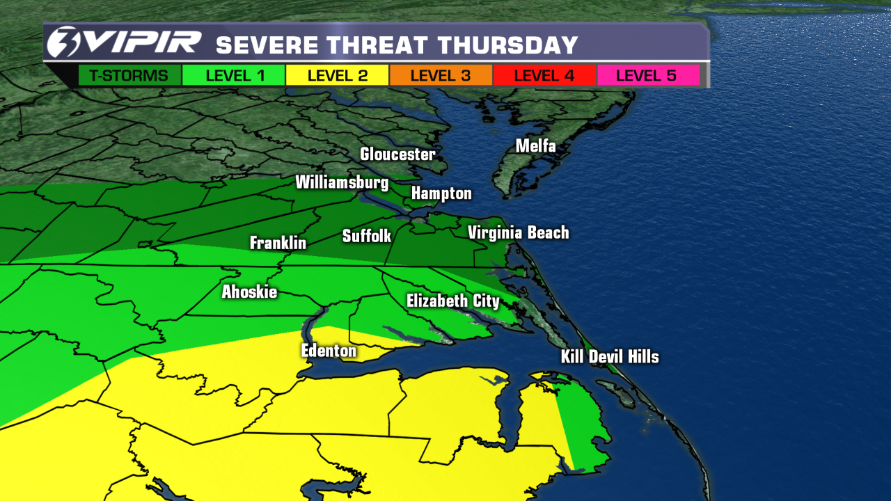 After a gorgeous Wednesday, the weather will be taking an ugly turn on Thursday. An area of low pressure will spin by to our south, bringing us scattered showers for the first part of the day and a few thunderstorms in the afternoon and evening hours. Some of the storms could be on the strong-to-severe side, especially across coastal North Carolina.
Our biggest concern with Thursday's storms will be with damaging straight-line winds. But large hail, localized flooding and an isolated tornado are all possible. The Storm Prediction Center has placed parts of eastern North Carolina in a category 2 severe weather threat. So we'll be tracking the storms very closely. Be VIPIR Ready.
A little bit of wet weather may linger into very early on Friday. But the bulk of the day is looking dry and very pleasant, with sunshine and highs in the mid 7os.
The Memorial Day weekend is looking great, with lots of sunshine from beginning to end. Expect 60s on Saturday, 70s on Sunday and 80s on Monday.
Weather & Health for Thursday
Pollen: Low-Moderate (Grasses, Oak, Mulberry)
UV Index: Low-Moderate
Air Quality: Good (Code Green)
Mosquitoes: Low-Moderate
Today in Weather History (NWS Wakefield)
1973 F0 Tornado: Suffolk
1973 F2 Tornado Pasquotank Co
2008 Wind Damage & Hail Southeast VA, Northeast NC from line of Thunderstorms
Patrick Rockey
NewsChannel 3 Chief Meteorologist
Join me on Facebook HERE.
Follow me on Twitter HERE.
Check Interactive Radar here: http://wtkr.com/weather/maps-and-radar/interactive-radar/
