


We woke up to showers and even a few thunderstorms for Thanksgiving morning. It looks like on Black Friday morning we will wake up to areas of dense fog.
That fog should start to settle in this evening and thicken up through the overnight hours.
By mid morning the fog will burn off and we will end up with a mixture of clouds and sunshine with high temperatures climbing into the mid 60s. A spotty shower is not out of the question on Friday.

Another round of fog is possible on Saturday morning. And then we can expect more sunshine through the day. It won’t be quite as warm, with high temperatures in the lower 60s.
And that cooling trend continues on Sunday with increasing clouds but decreasing temperatures. Expect highs in the upper 50s and lower 60s.
But temperatures will head in the opposite direction on Monday. Ahead of a cold front, expect the mercury to climb into the upper 60s and even some lower 70s. Showers are likely throughout the day on Monday. And as much colder air filters in on Monday night, some of us could even see a few snowflakes mixed in with the rain.
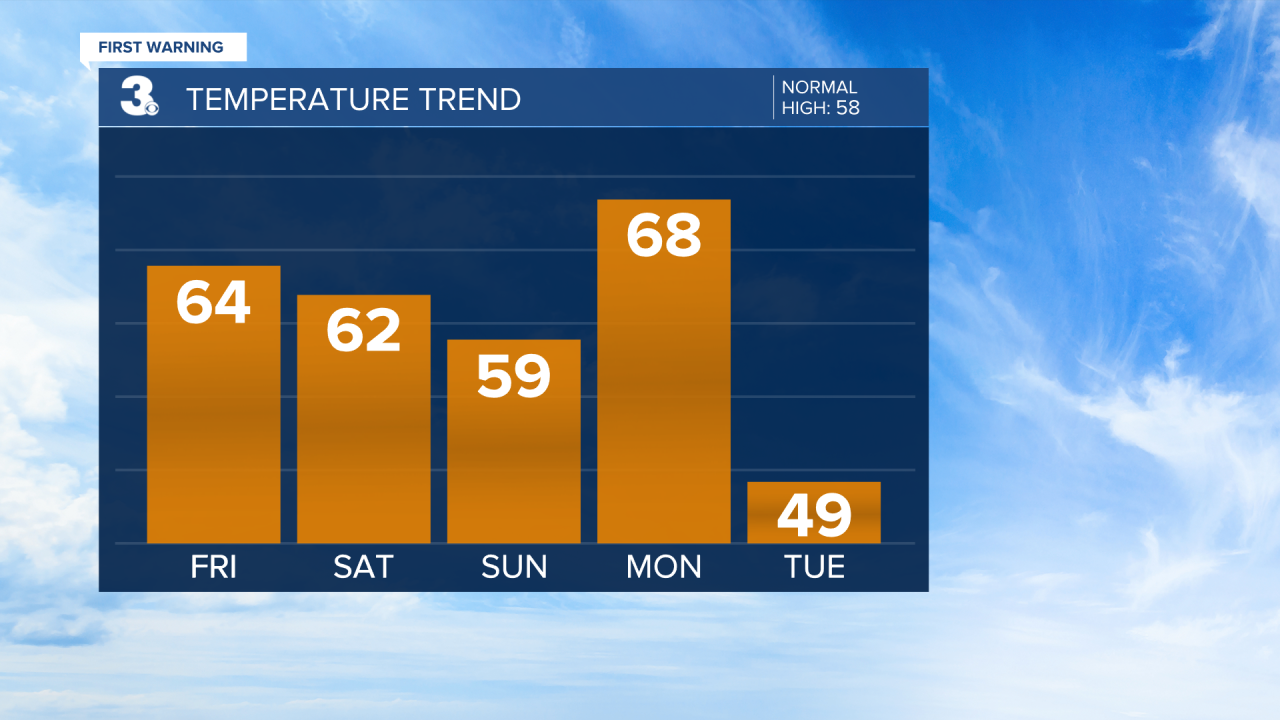
The rain will be gone by Tuesday morning, but the chillier air is just getting started. Expect highs only in the upper 40s and low 50s for the rest of the work week.
Weather & Health
