


Chief Meteorologist Patrick Rockey's First Warning Forecast
What you see is not what you get this week, at least weather wise. After a cool beginning to the work week, we expect a nice warm up with high temperatures in some areas flirting with the 70s by the end of the work week.
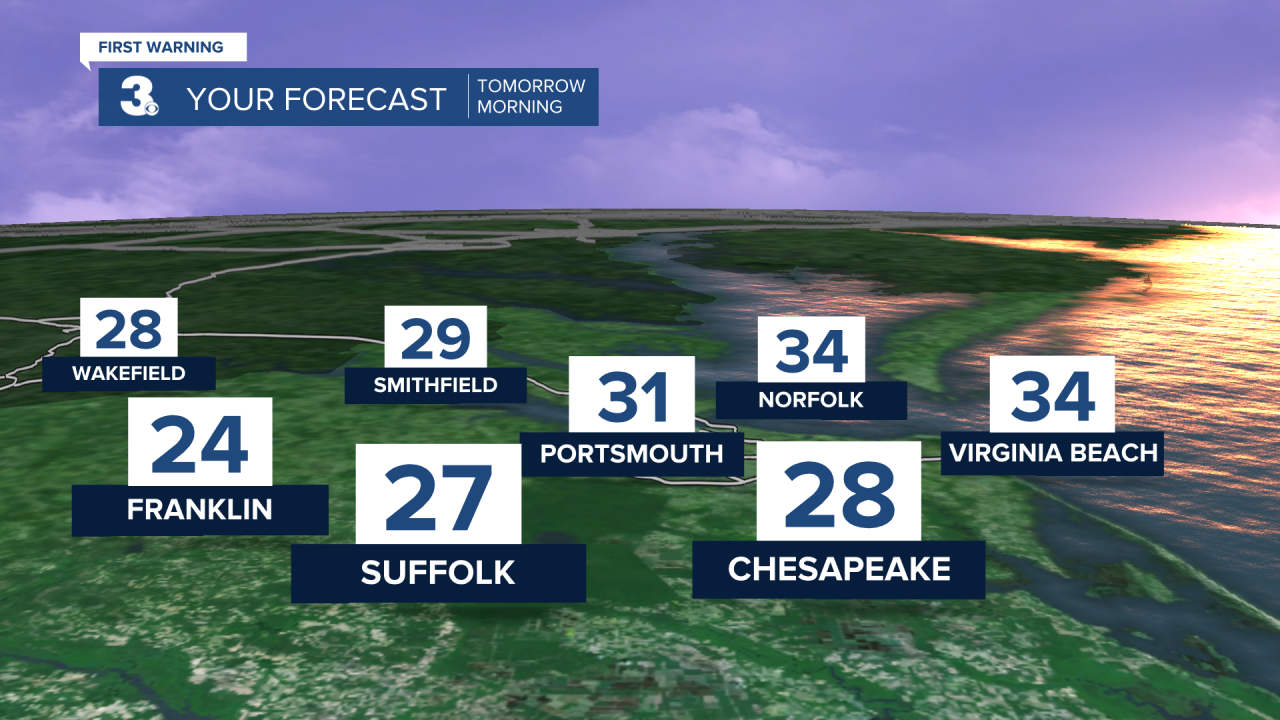
But it will be a chilly start to your Tuesday. Under clear to partly cloudy skies most of us will wake up to temperatures in the upper 20s and the lower 30s.
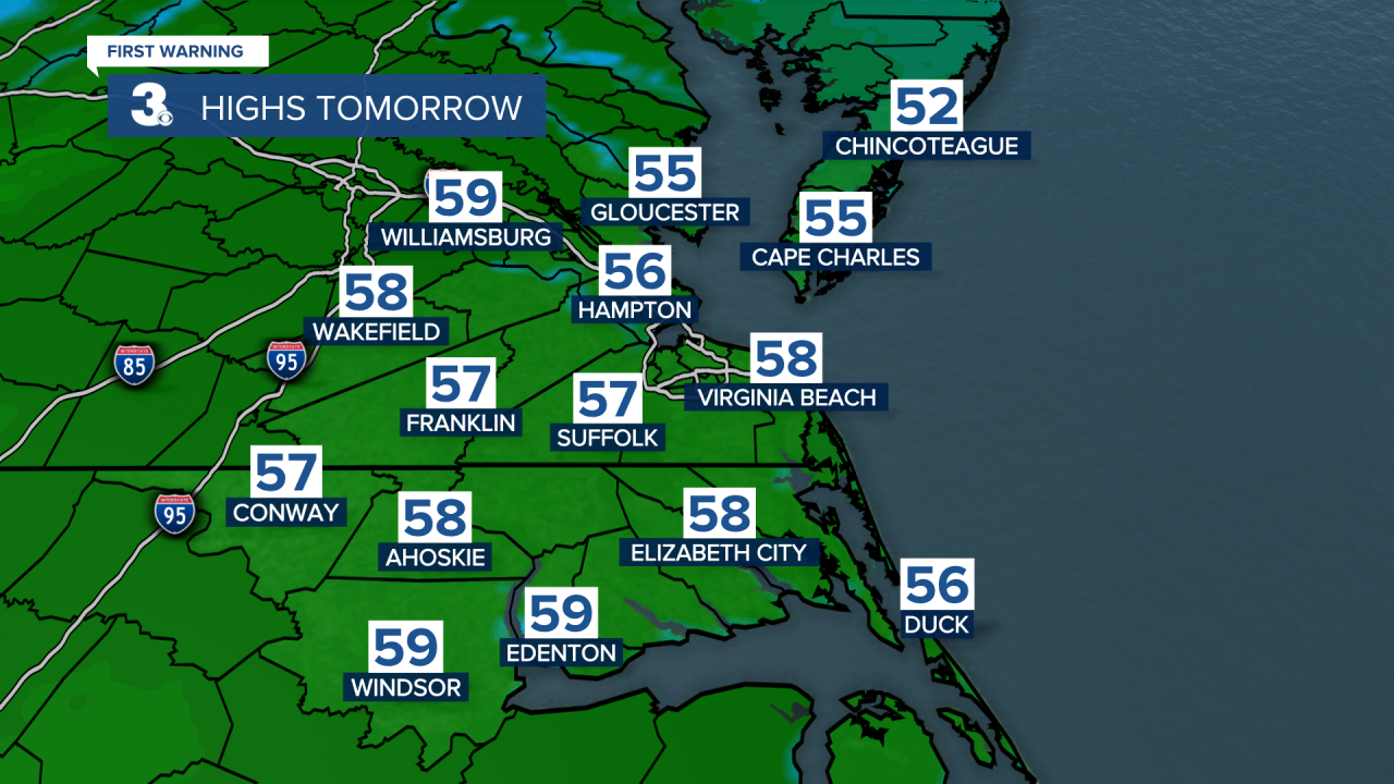
But by the afternoon expect near-normal high temperatures in the mid-to-upper 50s.
The warming trend continues on Wednesday. It looks like we will kick off December with high temperatures in the lower 60s.
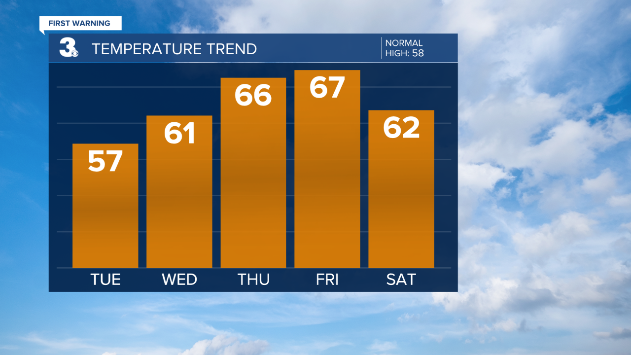
And even warmer weather rolls in for Thursday and Friday. Most of us will make it into the mid-to-upper 60s, but a few areas may even touch the 70 degree mark.
But a powerful cold front arrives this weekend. That will bring us below-normal temperatures on Sunday and then a chance for much-needed rain late Sunday and into Monday.
Patrick Rockey
Chief Meteorologist
