


Meteorologist Myles Henderson’s First Warning Forecast
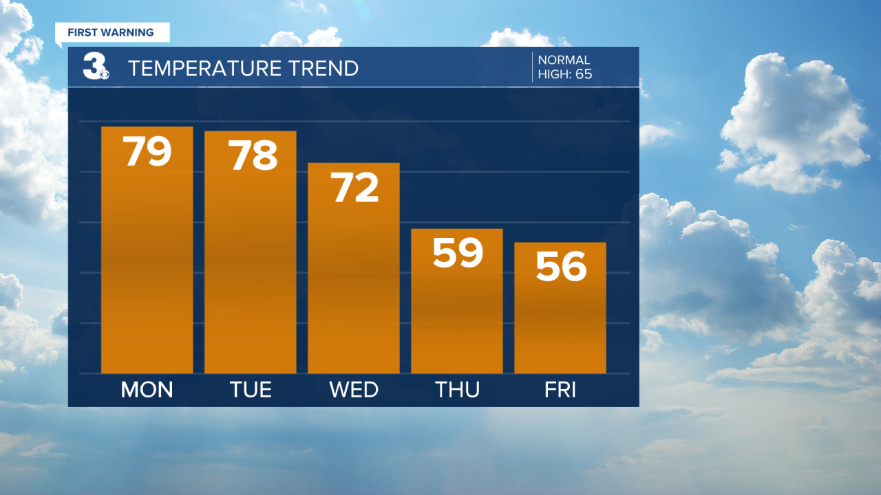
A warm start to the week with highs in the 70s. Several chances for showers and storms. Sunny and cooler to end the week.
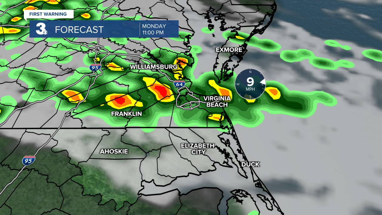
We will see a mix of clouds today with highs reaching the upper 70s, about 15 degrees above normal for this time of year. Scattered showers and storms will build in tonight. Some storms could be strong to severe with heavy downpours, gusty winds, and hail.
Highs will return to the upper 70s tomorrow with a mix of clouds. Scattered showers and storms are possible, but chances look lower for Tuesday.
Rain and storm chances will increase for Wednesday as a cold front moves through. The wind will also ramp up with gusts to 30+ mph. Strong to severe storms are possible. The cold front will also bring in cooler air, highs will drop from the 70s on Wednesday to the 50s to end the week.
Today: Mix of Clouds. Highs in the upper 70s. Winds: SW/N 5-15
Tonight: Showers & Storms. Lows in the mid 50s. Winds: N/E 5-15
Tomorrow: Mix of Clouds. Highs in the upper 70s. Winds: S/W 5-15
Weather & Health
Pollen: Medium-High (Maple, Juniper, Birch)
UV Index: 5 (Moderate)
Air Quality: Good (Code Green)
Mosquitoes: Low
Weather updates on social media:
Facebook: MylesHendersonWTKR
Instagram: @MylesHendersonWTKR
X (Twitter): @MHendersonWTKR
