


Meteorologist Myles Henderson’s First Warning Forecast
Storms to end the work week. Much cooler and less humid for Mother’s Day weekend.
More showers and storm today as a cold front moves through the region. Scattered showers are possible this morning with another round of rain and storms this afternoon to evening. Strong to severe storms are possible. Highs will reach the mid 80s today and it will still be humid.

We will fall to the mid 70s on Friday, near normal for this time of year. The humidity will be slowly falling throughout the day. Expect a mix of partly to mostly cloudy skies with scattered showers and storms, mainly in the afternoon.
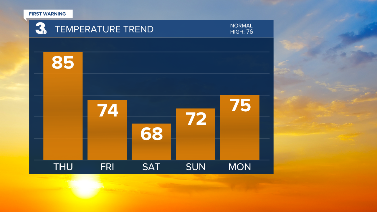
Even cooler this weekend and it will feel more like spring with much lower humidity. Highs will struggle to reach 70 on Saturday and only reach the low 70s on Sunday. We will see a nice mix of sun and clouds with lower rain chances.
Today: Mix of Clouds, Showers & Storms. Highs in the mid 80s. Winds: SW 5-15
Tonight: Partly Cloudy. Lows in the mid 60s. Winds: NW 5-10
Tomorrow: Mix of Clouds, Showers & Storms. Highs in the mid 70s. Winds: NW 5-15
Weather & Health
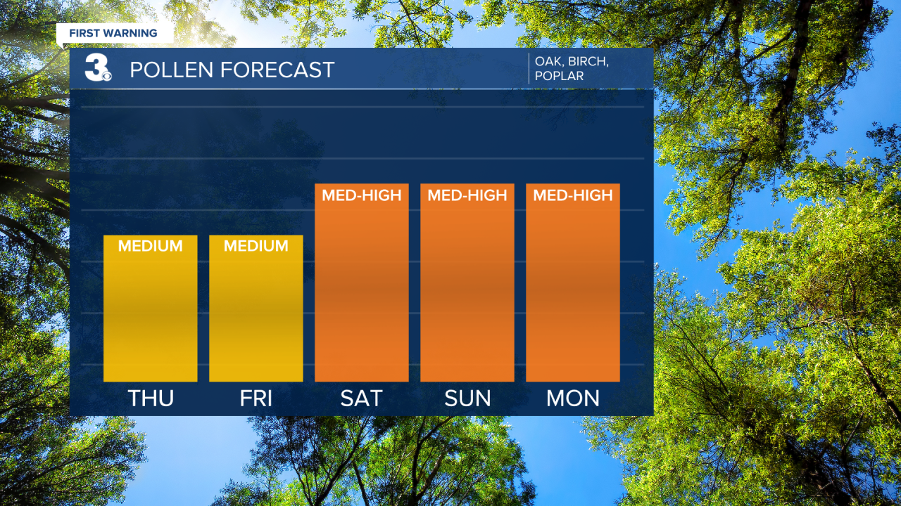
Pollen: Moderate (Oak, Birch, Poplar)
UV Index: 2 (Low)
Air Quality: Good (Code Green)
Mosquitoes: High
Weather updates on social media:
Facebook: MylesHendersonWTKR
Instagram: @MylesHendersonWTKR
X (Twitter): @MHendersonWTKR
