


UPDATE: The tornado watch now includes the Southside, Hertford and Gates counties in North Carolina. This means conditions are favorable for a tornado to form.

UPDATE: A tornado watch has been issued until 7 p.m. for the Peninsulas & our inland communities. This means conditions are favorable for a tornado to form.

Meteorologist Myles Henderson’s First Warning Forecast
A cold front brings in showers, storms, wind, and a cool down. Highs in the 50s to end the week.
Scattered showers and storms today as a cold front moves through the region. Strong to severe storms are possible with damaging wind gusts, hail, and an isolated tornado. The wind will also ramp up with gusts to 30+ mph. Highs will reach the low to mid 70s today.

The cold front will also bring in cooler air, highs will drop to the low 60s on Thursday and to the upper 50s on Friday. Expect a mix of sun and clouds with isolated showers to end the workweek. It will remain windy with west winds at 10 to 20 mph with higher gusts.
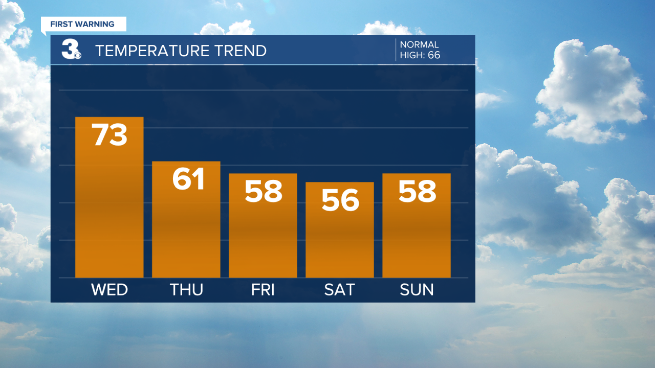
Highs will remain in the mid to upper 50s this weekend. We will see a mix of sun and clouds with low rain chances. It will still be on the breezy side with NW/N winds.
Today: Showers & Storms. Highs in the mid 70s. Winds: SW 10-20 G30
Tonight: Clearing Skies. Lows in the mid 40s. Winds: W 10-15
Tomorrow: Partly Cloudy. Highs in the low 60s. Winds: W 10-20 G30
Weather & Health
Pollen: Low-Medium (Maple, Juniper, Birch)
UV Index: 4 (Moderate)
Air Quality: Good (Code Green)
Mosquitoes: Low-Moderate
Weather updates on social media:
Facebook: MylesHendersonWTKR
Instagram: @MylesHendersonWTKR
X (Twitter): @MHendersonWTKR
