


Chief Meteorologist Patrick Rockey's First Warning Forecast
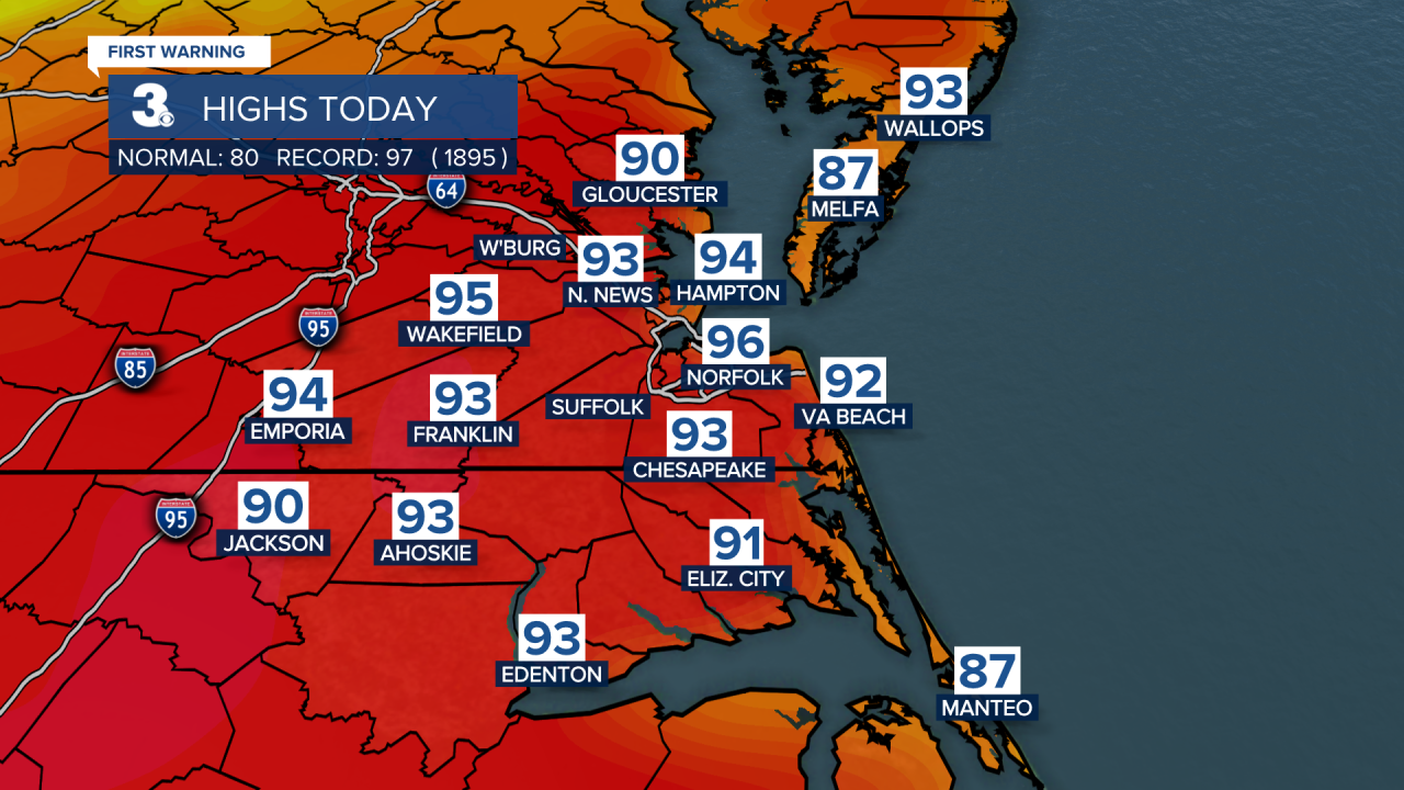
The first day of fall certainly didn’t feel like it. As a matter of fact, this was our hottest day since July!
But a cold front moving through this evening will usher in breezy and sharply cooler weather, as we end the work week and head into the weekend.
In fact, some of us may not even get out of the 60s for high temperatures on Friday despite plenty of sunshine. A gusty north wind will make it feel even cooler.
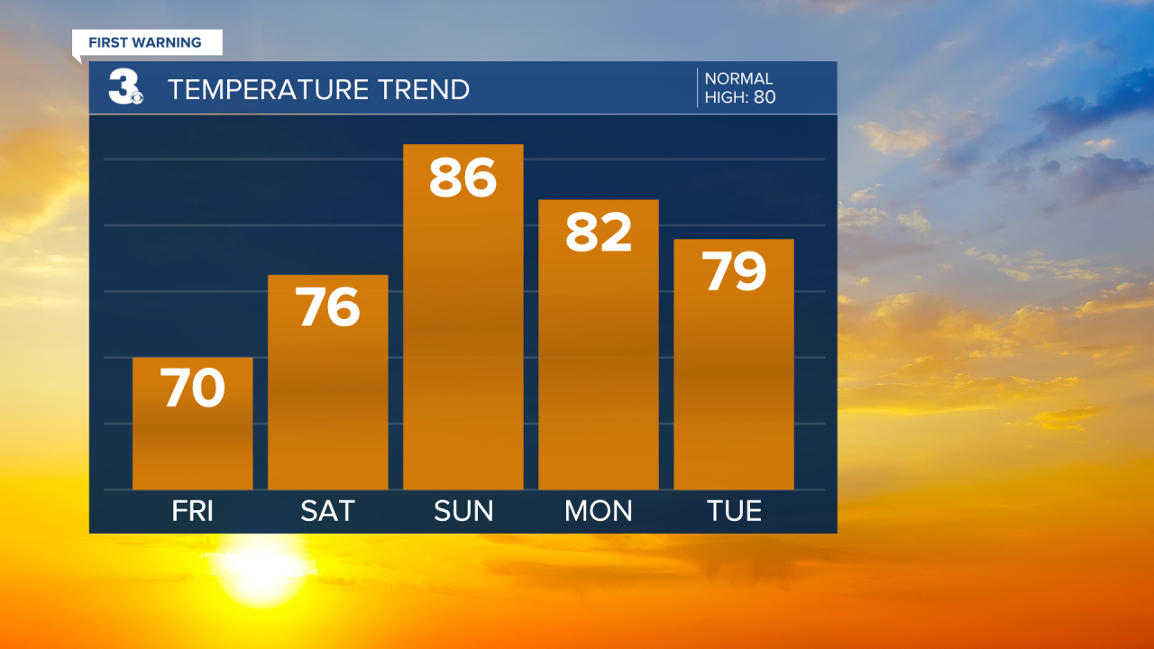
The winds should die down and temperatures will warm up for the first half of the weekend on Saturday. Under partly cloudy skies we expect to top out in the mid 70s.
The second half of the weekend will feel a lot more like summer once again with high temperatures climbing into the mid 80s.
But an approaching cold front could bring us a few showers Sunday evening and those may linger into Monday morning.

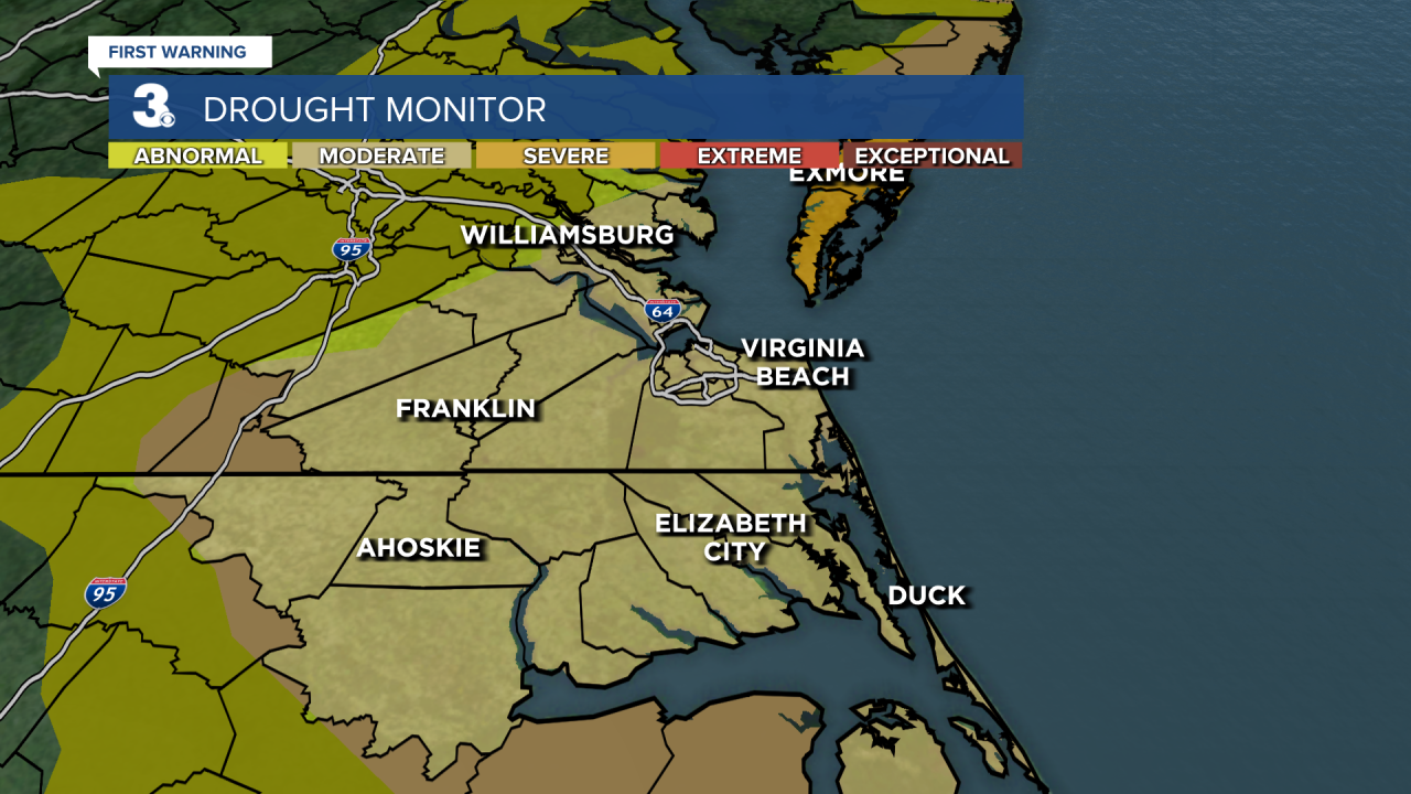
And we desperately need more rain. Our area is under a moderate drought. And the eastern Shore of Virginia is considered under severe drought.
Behind the cold front, we fall back into the 70s for Tuesday and Wednesday. And on Thursday some of us may not even get out of the 60s.
We are tracking what will likely end up being Tropical Storm Hermine. That system is expected to impact the gulf coast states and could eventually bring us rain late next week and into next weekend. Stay tuned.
