


Meteorologist Myles Henderson’s First Warning Forecast
Another hot and humid day… Today will be the hottest day of the week. Highs will climb to the low 90s with an afternoon heat index in the triple digits. Expect a nice mix of sun and clouds with scattered showers/storms firing up in the afternoon.
Highs will drop to the mid 80s on Friday, but it will still be humid. We will see partly to mostly cloudy skies tomorrow with a bigger chance for showers and storms.
This weekend will be very typical for August. We will see a nice mix of sun and clouds, with scattered showers/storms popping up in the afternoon. Highs will remain in the mid to upper 80s, near normal for this time of year.
Today: Partly Cloudy, “Pop-up” Storms. Highs in the low 90s. Winds: SW 5-10
Tonight: Partly to Mostly Cloudy. Lows in the mid 70s. Winds: S 5-10
Tomorrow: Mix of Clouds, Showers & Storms. Highs in the mid 80s. Winds: W/N/E 5-10
Weather & Health
Pollen: Medium (Ragweed, Grasses)
UV Index: 9 (Very High)
Air Quality: Good (Code Green)
Mosquitoes: Extreme
Tropical Update
Post-Tropical Cyclone Fred moving into southern New York. Fred is moving ENE at 17 mph and this motion is expected to slow down through Friday.

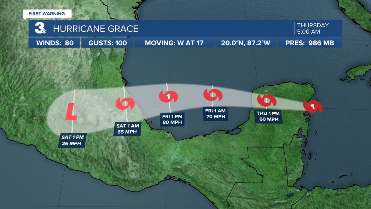
Hurricane Grace moving over the Yucatan Peninsula. A general west to WNW motion is expected through Friday, followed by a general west to WSW motion. On the forecast track, Grace will move across the Yucatan Peninsula today, and over the southwest Gulf of Mexico late tonight through Friday.
Maximum sustained winds have decreased to 75 mph with higher gusts. Grace is expected to continue to weaken as it crosses Yucatan, but re-intensification is expected when the center reaches the Gulf of Mexico. Grace is expected to be a hurricane when it makes its second landfall on the mainland coast of Mexico.
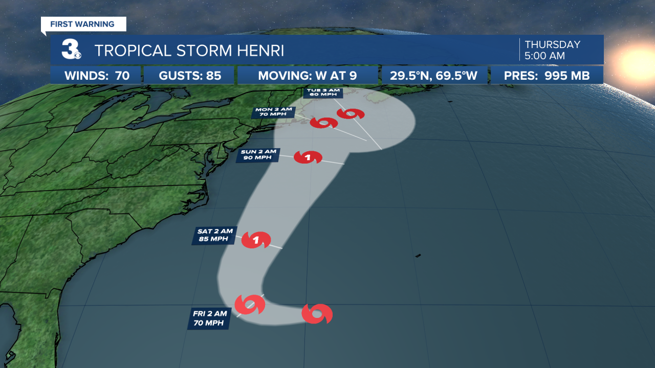
Tropical Storm Henri forecast to become a hurricane by Friday. Henri is centered about 525 miles SE of Cape Hatteras, NC and moving west at 9 mph. A turn toward the NW is forecast on Friday, followed by an acceleration toward the north and NNE Saturday and Sunday. On the forecast track, the center of Henri will remain well offshore the east coast of the United States over the next couple of days but could approach southeastern New England on Sunday.
Maximum sustained winds are near 70 mph with higher gusts. Some strengthening is forecast during the next few days, and Henri is expected to become a hurricane by Friday.
Weather updates on social media:
Facebook: MylesHendersonWTKR
Twitter: @MHendersonWTKR
Instagram: @MylesHendersonWTKR
