


Meteorologist Myles Henderson’s First Warning Forecast
A midweek warming trend. Tracking showers and storms to end the week.
Even warmer today with highs in the mid 80s, about 10 degrees warmer than yesterday and mostly sunny skies.

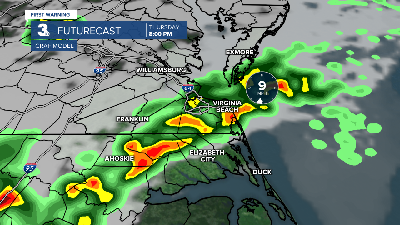
Thursday will be the warmest day of the week with highs near 90. Expect a mix of sun and clouds during the day with scattered showers and storms building in later in the day. Strong to severe storms are possible.
Scattered showers and storms will linger through the holiday weekend. Highs will drop to the low 80s for Friday and the weekend. Each day will bring partly cloudy skies with a chance for scattered showers and storms.
Today: A Few Clouds. Highs in the mid 80s. Winds: S 5-10
Tonight: A Few Clouds. Lows in the mid 60s. Winds: SW 5-10
Tomorrow: Partly Cloudy. Highs near 90. Winds: SW 5-10
Weather & Health
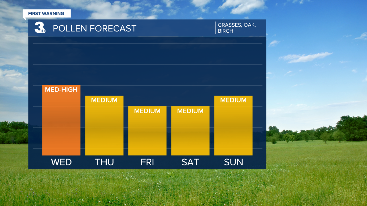
Pollen: Mod-High (Grasses, Oak, Birch)
UV Index: 10 (Extreme)
Air Quality: Good (Code Green)
Mosquitoes: High
Weather updates on social media:
Facebook: MylesHendersonWTKR
Instagram: @MylesHendersonWTKR
X (Twitter): @MHendersonWTKR
