


UPDATE: Parts of our region have been upgraded to a rare LEVEL 3 severe storm threat for tonight.
Our top concerns are damaging wind gusts and large hail. The tornado threat is lower, but not zero.
The most likely time for severe storms will be between 6 p.m. to 10 p.m.

Meteorologist Myles Henderson’s First Warning Forecast
A line of storms set to move through tonight. Temperatures ranging from the 60s to 80s this week.
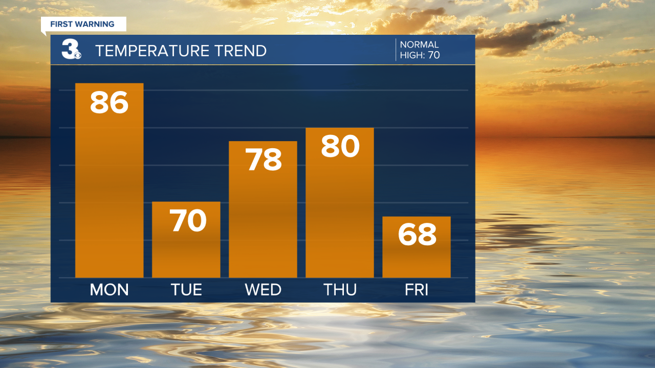
A warm start to the week with highs reaching the mid 80s this afternoon, about 15 degrees above normal for this time of year. We will see mostly sunny to partly cloudy skies today, but scattered showers and storms will move through tonight. Some storms could be strong to severe with damaging wind gusts and hail possible.

A step cooler tomorrow with highs near 70, near normal. We will see partly cloudy skies with a slim rain chance.
Highs will warm back to the upper 70s on Wednesday and near 80 on Thursday. We will dip back to the 60s for Friday. Most of the workweek will be a mix of partly to mostly cloudy skies with a few showers possible.
Today: Mostly Sunny to Partly Cloudy. Highs in the mid 80s. Winds: W 5-15
Tonight: Scattered Storms. Lows near 60. Winds: W/N 5-10
Tomorrow: Partly Cloudy. Highs near 70. Winds: N/E 5-15
Weather & Health
Pollen: High (Oak, Maple, Alder)
UV Index: 7 (High)
Air Quality: Good (Code Green)
Mosquitoes: Moderate

Weather updates on social media:
Facebook: MylesHendersonWTKR
Instagram: @MylesHendersonWTKR
X (Twitter): @MHendersonWTKR
