Since February has been an unusually warm and wet month, it is fitting that the last few days of the month include showers, possible thunderstorms and springlike temperatures.
However, it looks like we are going to head into March on a much chillier and dry note as a powerful cold front crosses the region.
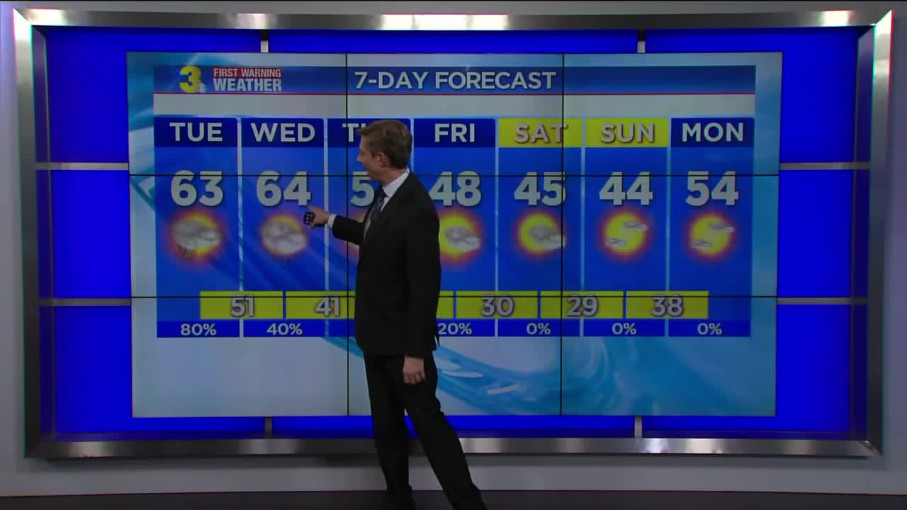
It looks like we will wake up to wet weather on Tuesday morning, with a few heavier downpours. But our rain chances will drop throughout the day even as our temperatures rise back into the 60s.
Wednesday will also feature temperatures well into the 60s. But an approaching cold front will bring showers and possibly a few thunderstorms as we head into the afternoon and then a huge drop in temperatures.
Expect clearing skies on Thursday with high temperatures only in the lower 50s.
And the cooldown continues on Friday with highs only in the upper 40s under partly cloudy skies.
It will be a chilly weekend as we transition from February to March. Expect clear-to-partly cloudy skies with high temperatures only in the low-to-mid 40s.
The latest long range forecast for March features below-normal temperatures for our region. Bundle up!
Patrick's First Warning Forecast: Falling rain then falling temps
A few thunderstorms also possible


Posted
and last updated
Copyright 2020 Scripps Media, Inc. All rights reserved. This material may not be published, broadcast, rewritten, or redistributed.
