

Chief Meteorologist David Aldrich's First Warning Forecast
This evening will be pleasant, with mainly clear skies and temperatures in the 70s after sunset, still breezy. Overnight lows will only drop into the upper 50s and 60s.
Tomorrow morning will start out with a mix of sun and clouds followed by overcast skies developing by midday. We'll stay warm with high temperatures in the upper 70s to lower 80s. Winds will be out of the SSW at 10-25 mph with gusts up to 35 to 40 mph. A few hit or miss showers are possible with a 30% chance of rain in place.
Tomorrow night, showers and isolated storms will remain possible, with low temperatures only reaching the 60s.
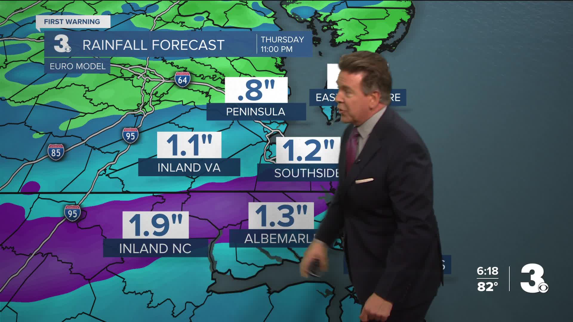
Thursday will be a rainy day, with steady rain and embedded thunderstorms likely all day long. We'll see high temperatures near 70 degrees, along with winds out of the N at 10-20 mph. Between 0.5" and 1.5" of rain is expected region wide, which would be very beneficial given our drought conditions. Rain will transition to leftover showers Thursday evening, with partly cloudy skies and mainly dry conditions emerging on Friday.
Looking ahead to the weekend...
Mother's Day weekend looks to be nice, with a few showers possible Saturday, 30% chance, along with partly cloudy skies and high temperatures in the mid to upper 70s.
Mother's Day looks very nice, with highs in the lower 80s and partly cloudy skies expected with just a 10% chance of stray showers in the afternoon.


Weather updates on social media:
Facebook: AldrichWeather
Instagram: @davidaldrichweather
X (Twitter): @AldrichWeather
