

Chief Meteorologist David Aldrich's First Warning Forecast
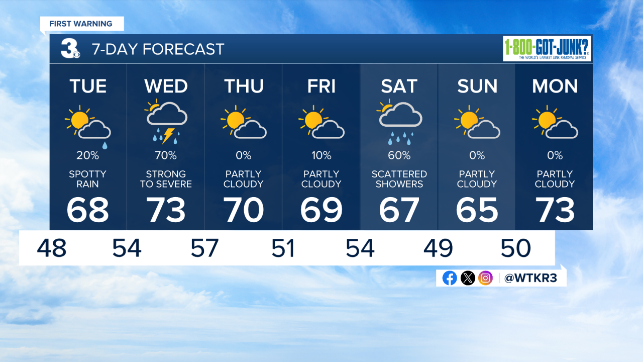
Some like it cool in late April, and if that is you, then you are in luck. Tonight, look for mostly clear skies with cool and crisp air and lows in the upper 30s to 40s.
More clouds are expected to roll in on Tuesday with partly to mostly cloudy skies. Some drizzle or spotty rain is possible, but not likely at 20% chance or less.
Highs on Tuesday, should reach the upper 60s along the coast and lower 70s inland.
Most of the rain on Wednesday should arrive by midday and beyond.
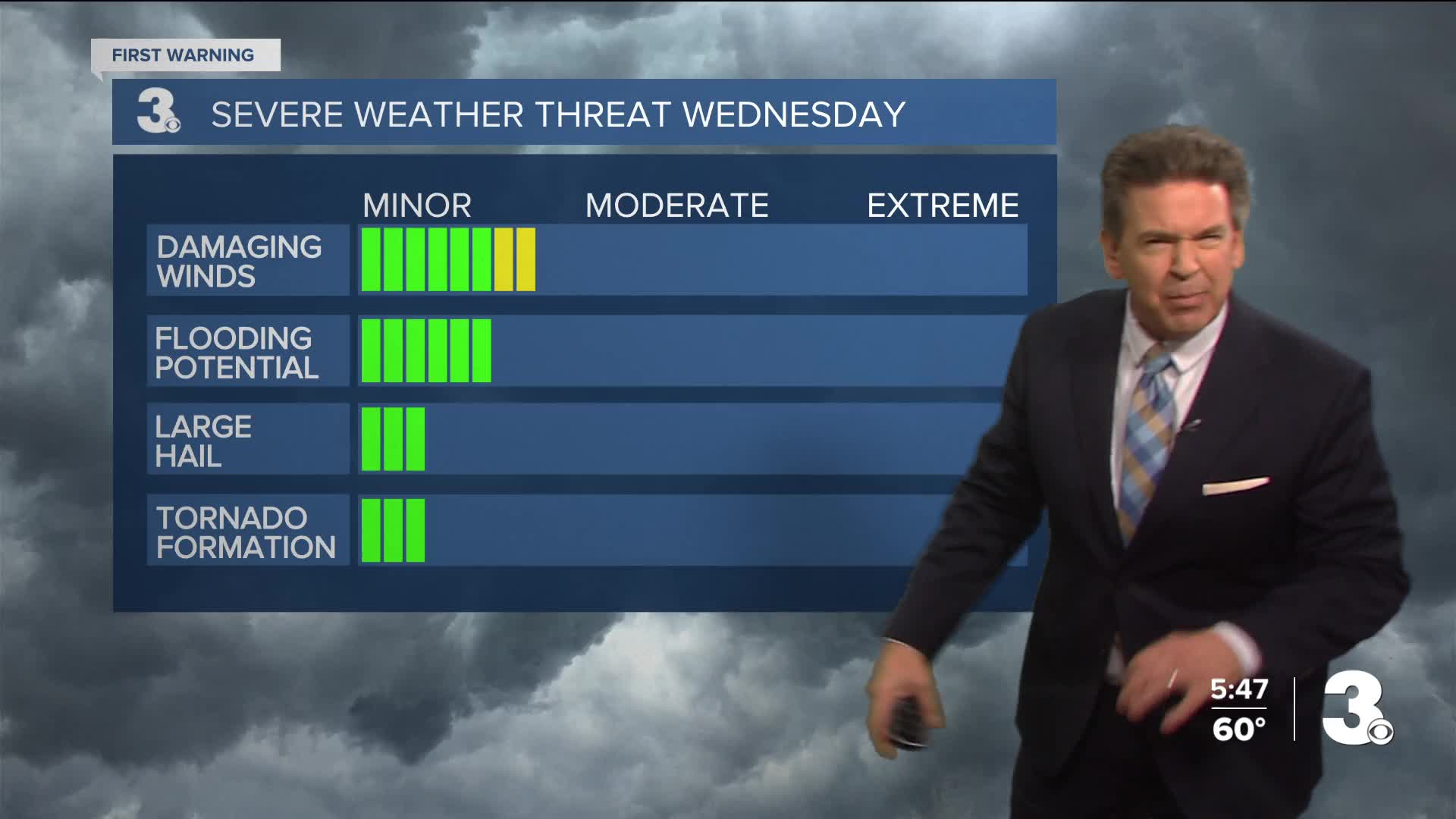
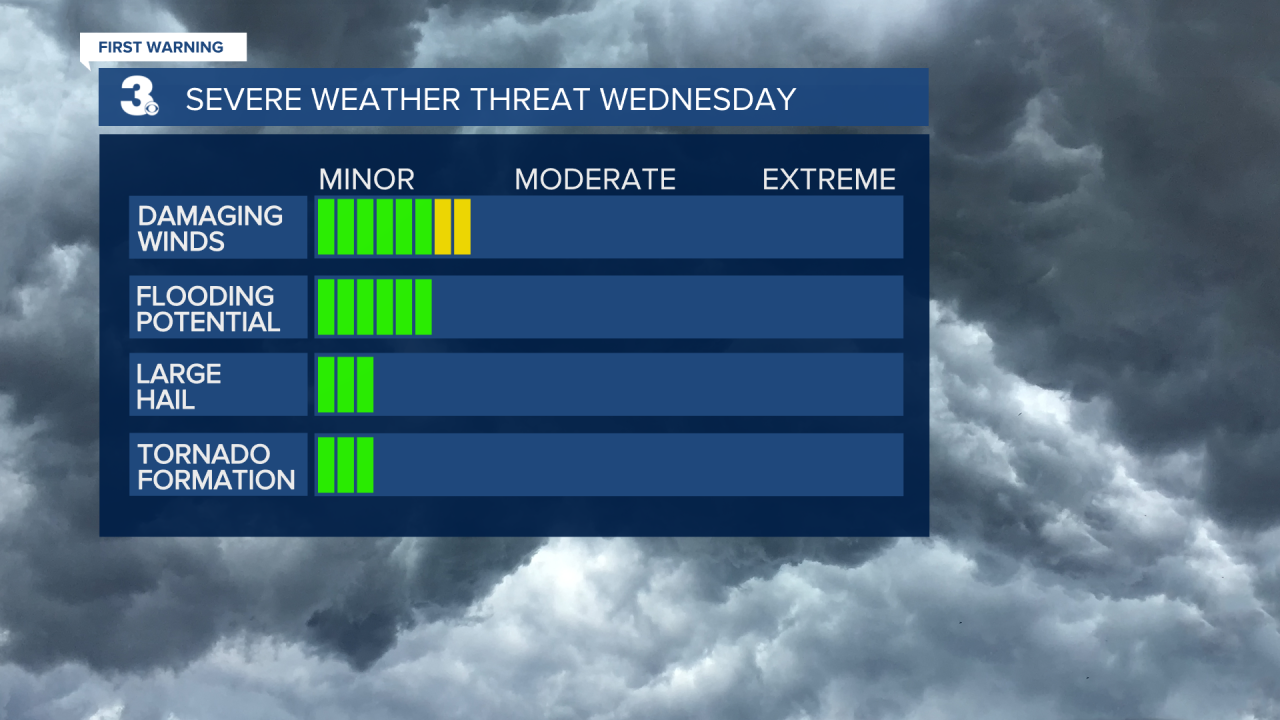
Stronger storms arrive on Wednesday evevning with a Level 1 Severe storm outlook, meaning isolated severe storms with gusts around 60 mph will be possible by evening.
Looking ahead to the weekend, showers on Saturday may continue to grow if a Southern system rolls up the South Carolina and North Carolina coast. Right now, a 60% chance of rain for Saturday seems likely with plenty of clouds. Drier weather can be expected on Sunday.


Weather updates on social media:
Facebook: AldrichWeather
Instagram: @davidaldrichweather
X (Twitter): @AldrichWeather
