

Chief Meteorologist David Aldrich's First Warning Forecast
Expect overnight lows to drop into the 60s and 70s, as showers fade away.
With early clouds and more sunshine later on Monday, look for a cooler day with highs in the upper 70s to near 80 degrees. Monday should be our coolest day of the upcoming week.
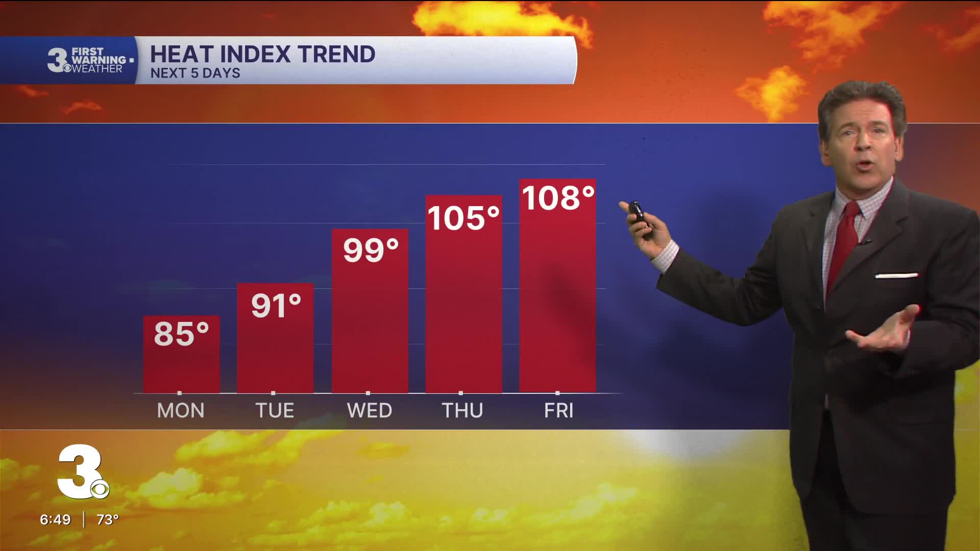
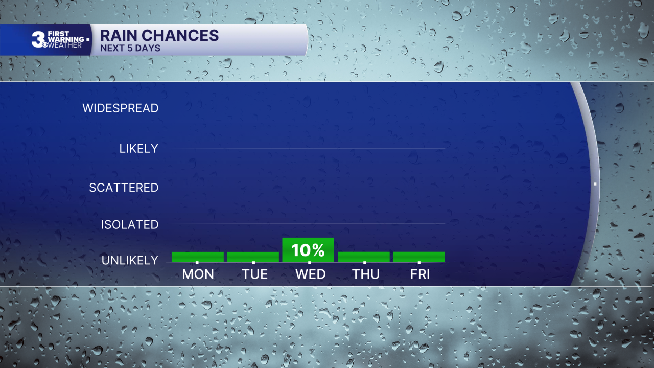
Hotter and more humid air is on the way, as we approach the Independence Day holiday and weekend. Interesting to note, a new area of interest from the National Hurricane Center was introduced into the Atlantic today with a 20% chance of tropical development off the coast of the Carolinas. Now, with extreme heat seemingly locked in place later this week....we will stay the course until newer information on a possible / maybe storm may / may not affect us with an abundance in clouds....or even rain...which seems slim.
My advice? Prepare for late week extreme heat here....and if necessary, our weather forecast for day 4 through 7 may need to pivot. Stay tuned.
This is Hampton Roads and Northeast North Carolina. Never a dull moment.
Chief Meteorologist David Aldrich


Weather updates on social media:
Facebook: AldrichWeather
Instagram: @davidaldrichweather
X (Twitter): @AldrichWeather
