

Chief Meteorologist David Aldrich's First Warning Forecast
With evening clouds decreasing...virtually clear skies before and around midnight...and early morning clouds returning, expect overnight lows to drop into the 40s and 50s.
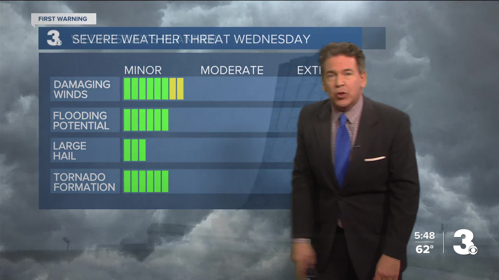
The risk for strong to isolated severe storms are on the table in Hampton Roads and Northeast North Carolina on Wednesday.
One, perhaps two, neighborhoods or more may experience some isolated severe storms, where winds could approach 60 mph. The risk for a spin-up tornado is running 2% or less, based on the Storm Prediction Center's assessment.
While severe storm development remains uncertain, if we get considerable amounts of sunshine during midday, that could further destabilize our environment, which could lead to stronger storms.
Drier weather is likely to return on both Thursday and Friday.
Looking ahead to this weekend, a new low pressure system is likely to form off the coast of South Carolina and North Carolina, bringing with it rainy conditions here on Saturday, but drier and still cool on Sunday. Both days should give us highs in the lower to mid 60s.


Weather updates on social media:
Facebook: AldrichWeather
Instagram: @davidaldrichweather
X (Twitter): @AldrichWeather
