

Chief Meteorologist David Aldrich's First Warning Forecast
Temperatures should rise overnight back into the 60s after briefly dropping into the 50s this evening.
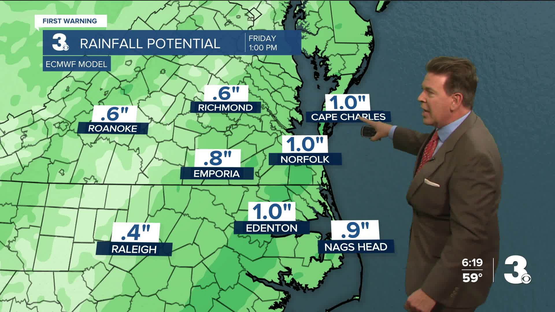
With 0.5" to 1.0" of rain expected tonight into early Friday morning for Hampton Roads & Northeast North Carolina, don't be surprised if locally higher rainfall amounts near 2.0" appears in a few locations around the Outer Banks.
The Outer Banks may also receive the strongest wind gusts overnight, as they are under a Level 1, isolated storms outlook, from the Storm Prediction Center (#SPC). The chance of a spin-up tornado in the Outer Banks overnight is about a 2% chance or less.
Peak wind gusts of 40 to 45 mph will be possible for many, while the Outer Banks could get peak wind gusts well over 60 mph.
Look for bright sunshine to develop by Friday afternoon, as temperatures should start to drop again after 10 AM Friday.
Looking ahead to the weekend, Saturday should be mostly sunny and cooler with highs in the upper 40s and partly cloudy on Sunday with highs in the upper 50s.


Weather updates on social media:
Facebook: AldrichWeather
Instagram: @davidaldrichweather
X (Twitter): @AldrichWeather
