




Meteorologist Myles Henderson’s First Warning Forecast
Several cool and windy days this week. Flooding risks near times of high tide.
A coastal storm will linger off the Carolina coast for the first half of the week. Strong N/NE winds will continue for several days, and multiple rounds of tidal flooding are expected. Rough surf and the potential for ocean overwash will continue. A few showers are possible along the coast, but overall rainfall will be limited.
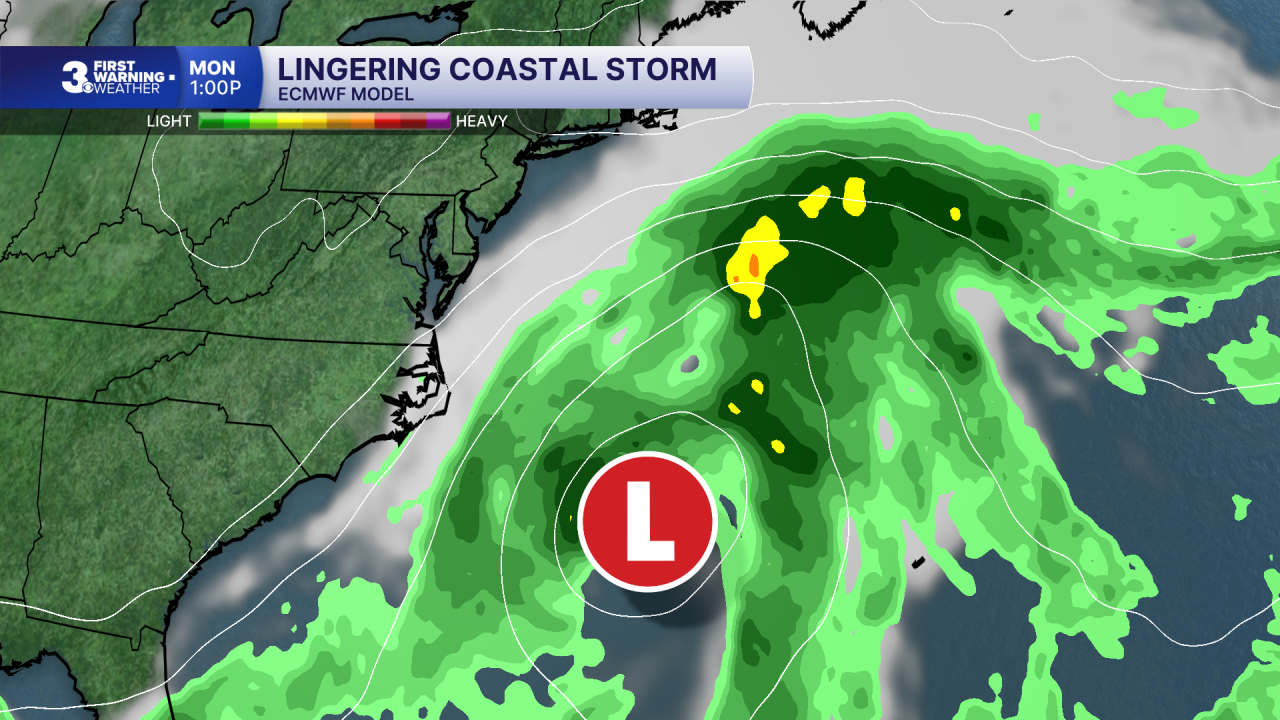
Expect a mix of sun and clouds today with more sunshine inland and more clouds near the coast. A spotty shower is possible but most of the area will stay dry. It will still be windy with a N/NE wind gusting over 30 mph inland and over 40 mph along the coast. Watch out for flooding near our afternoon high tide. Highs will reach the mid 60s today.
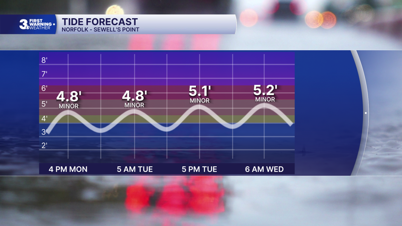
We will see more sunshine tomorrow with highs warming to the upper 60s. It will still be windy, and we will see additional flooding risks near high tide.
Highs will linger in the mid to upper 60s to end the week. It will still be breezy but the strong gusts will start to back down as the coastal low tracks away from our coastline.
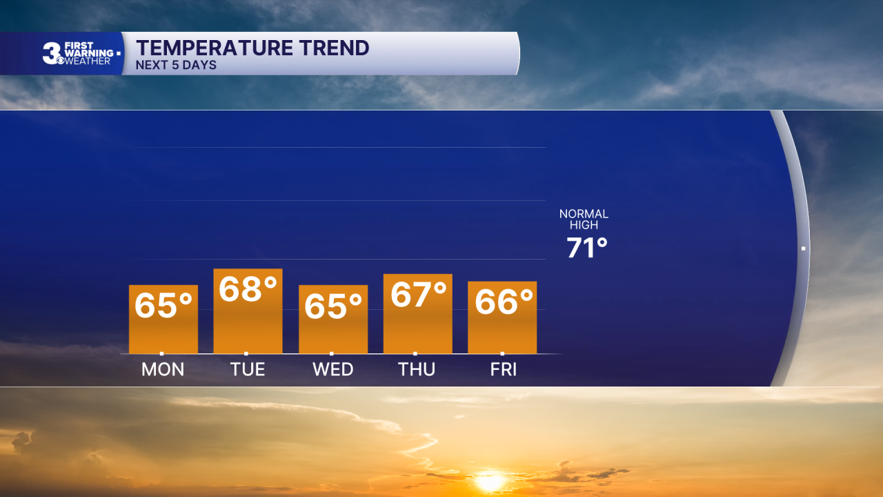
Today: Sun & Clouds, Windy. Highs in the mid 60s. Winds: N 15-25 G35
Tonight: Partly Cloudy, Windy. Lows in the mid 50s. Winds: N 10-20 G30
Tomorrow: A Few Clouds, Windy. Highs in the upper 60s. Winds: N 10-20 G30
Weather & Health
Pollen: Low-Medium (Ragweed)
UV Index: 3 (Low-Medium)
Air Quality: Good (Code Green)
Mosquitoes: High
Tropical Update
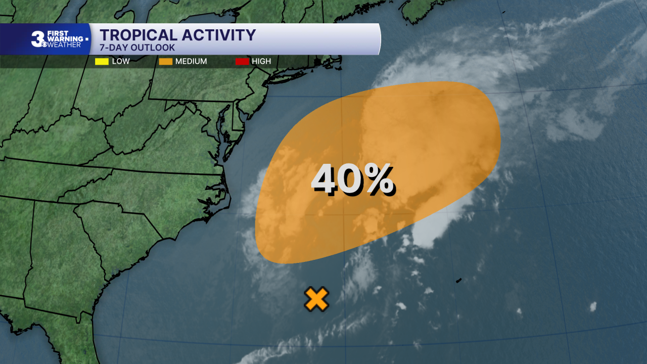
A low-pressure area is located along a frontal boundary a few hundred miles off the southeast coast of the United States. This low is likely to move slowly and erratically over the next couple of days, and it could gradually acquire subtropical characteristics if it remains over the Gulf Stream. A subtropical cyclone could form during the middle to latter portions of the week when the system begins to move northeast, away from the eastern United States.
* Formation chance through 48 hours: Low (0%)
* Formation chance through 7 days: Medium (40%)
Weather updates on social media:
Facebook: MylesHendersonWTKR
Instagram: @MylesHendersonWTKR
