




Meteorologist Myles Henderson’s First Warning Forecast
Calmer weather is returning this week. A fall-like start to the week, warming to the 80s for the second half of the week.
After a messy stretch to end last week, nicer weather moves in for this week. We will see partly cloudy skies today with light winds. Highs will reach the mid 70s, just below normal for this time of year. Some minor tidal flooding is possible as the coastal storm continues to push north.
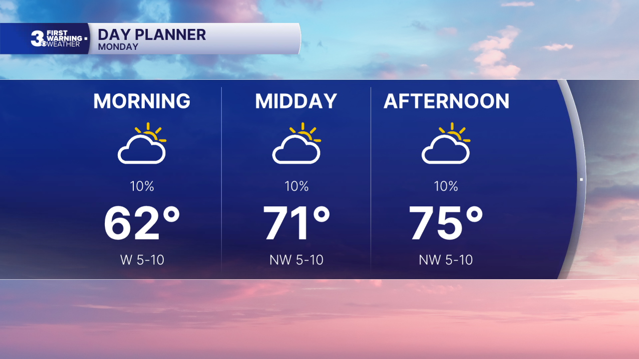
Another nice day tomorrow with partly cloudy skies, light winds, and highs in the mid 70s. We do warm up for the second half of the week. Highs will reach the low to mid 80s with a slight increase in humidity.
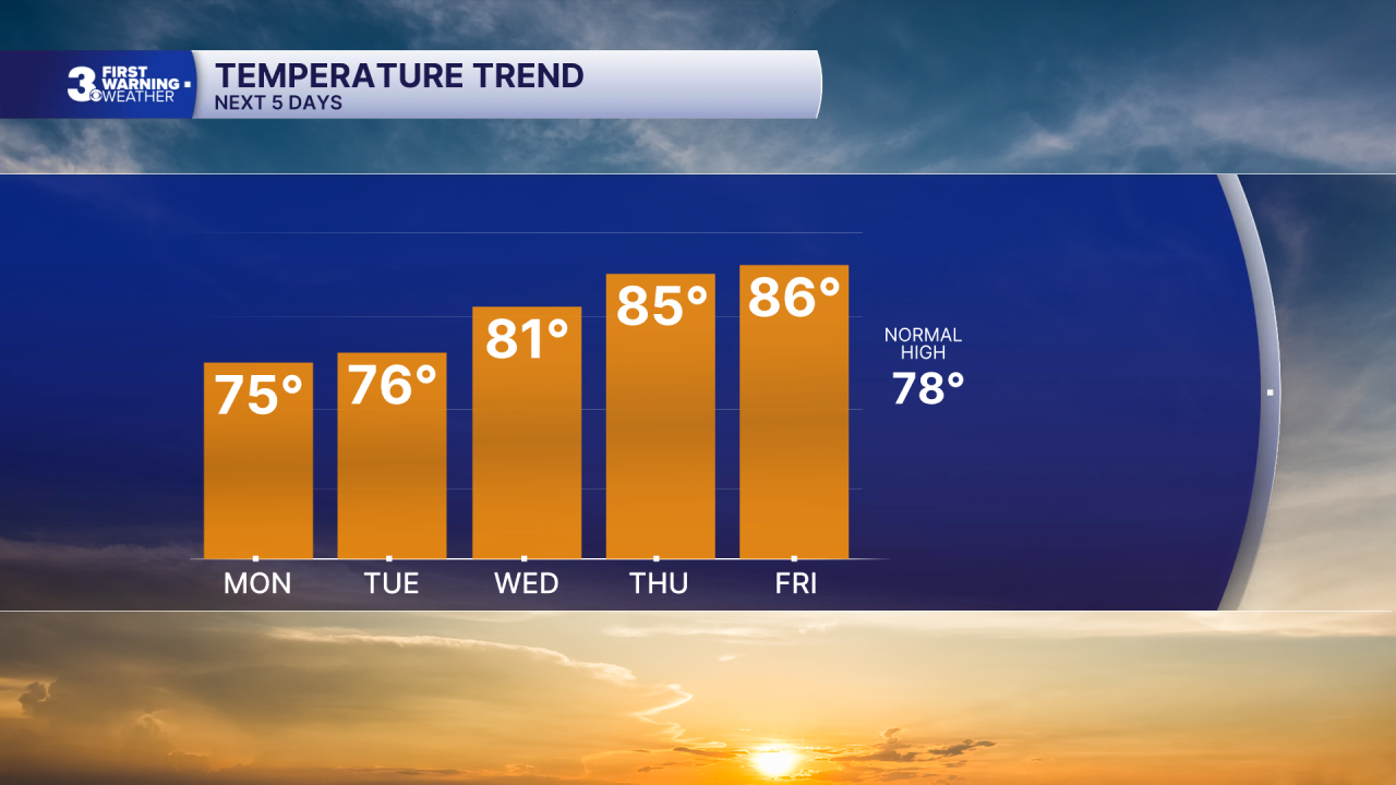
Rain chances return for Friday and the weekend as a cold front moves in and stalls out over the region. Highs will drop back to the 70s for the weekend, behind the front.
Today: Partly Cloudy. Highs in the mid 70s. Winds: NW 5-10
Tonight: Partly Cloudy. Lows in the mid 60s. Winds: N 5-10
Tomorrow: Partly Cloudy. Highs in the mid 70s. Winds: N 5-10
Weather & Health
Pollen: Low-Medium (Ragweed)
UV Index: 5 (Medium)
Air Quality: Good (Code Green)
Mosquitoes: High
Tropical Update
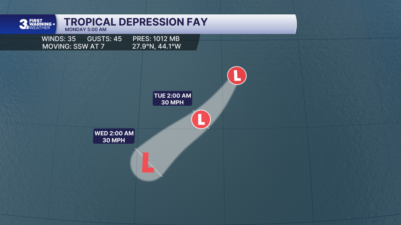
Tropical Depression Fay holding on over the central Atlantic. A SSW to SW motion is expected over the next couple of days, followed by a turn toward the WSW by mid-week. Maximum sustained winds are near 30 mph with higher gusts. Fay will likely become a remnant low in a day or two and dissipate later in the week.
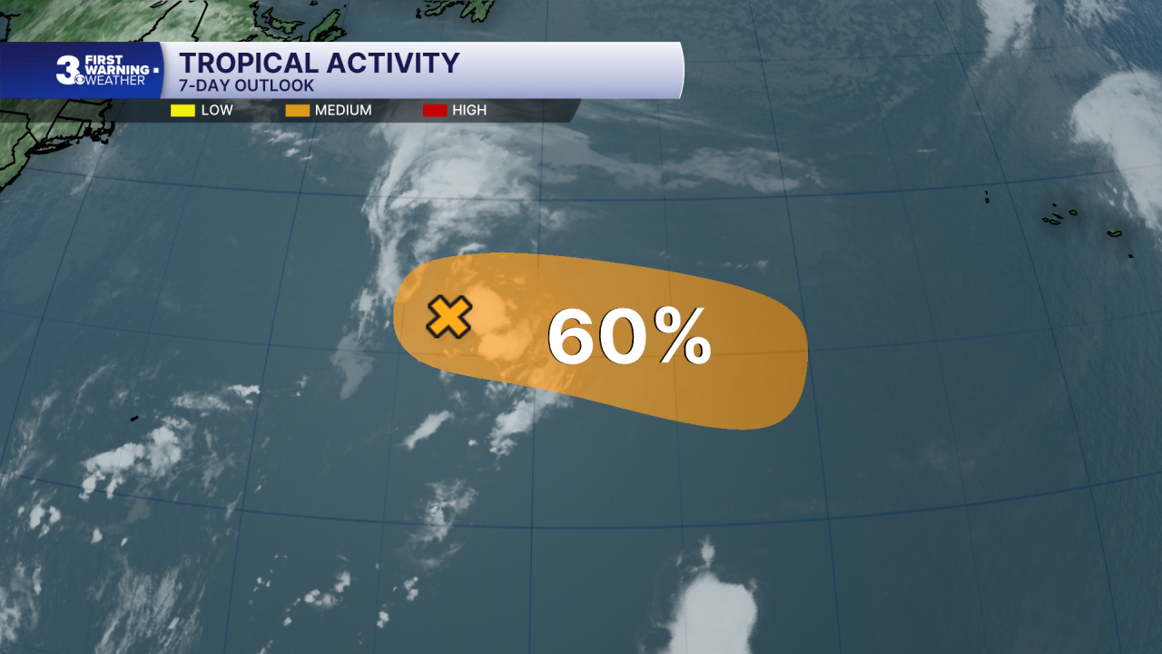
Watching a trough of low pressure located several hundred miles ENE of Bermuda. This system could become a tropical depression over the next couple of days as it turns east to ESE over the central Atlantic. Environmental conditions are expected to become unfavorable for further development later this week.
* Formation chance through 48 hours: Medium (50%)
* Formation chance through 7 days: Medium (60%)
Weather updates on social media:
Facebook: MylesHendersonWTKR
Instagram: @MylesHendersonWTKR
