


Meteorologist Myles Henderson’s First Warning Forecast
Tracking a few showers for Wednesday and a bigger rain chance for Thursday. Some temperature variety to end the week.
Warm and windy again day with highs near 80 and a SW wind at 10 to 20 with gusts to 30 mph. Look for partly to mostly cloudy skies with scattered showers possible, mainly around midday.

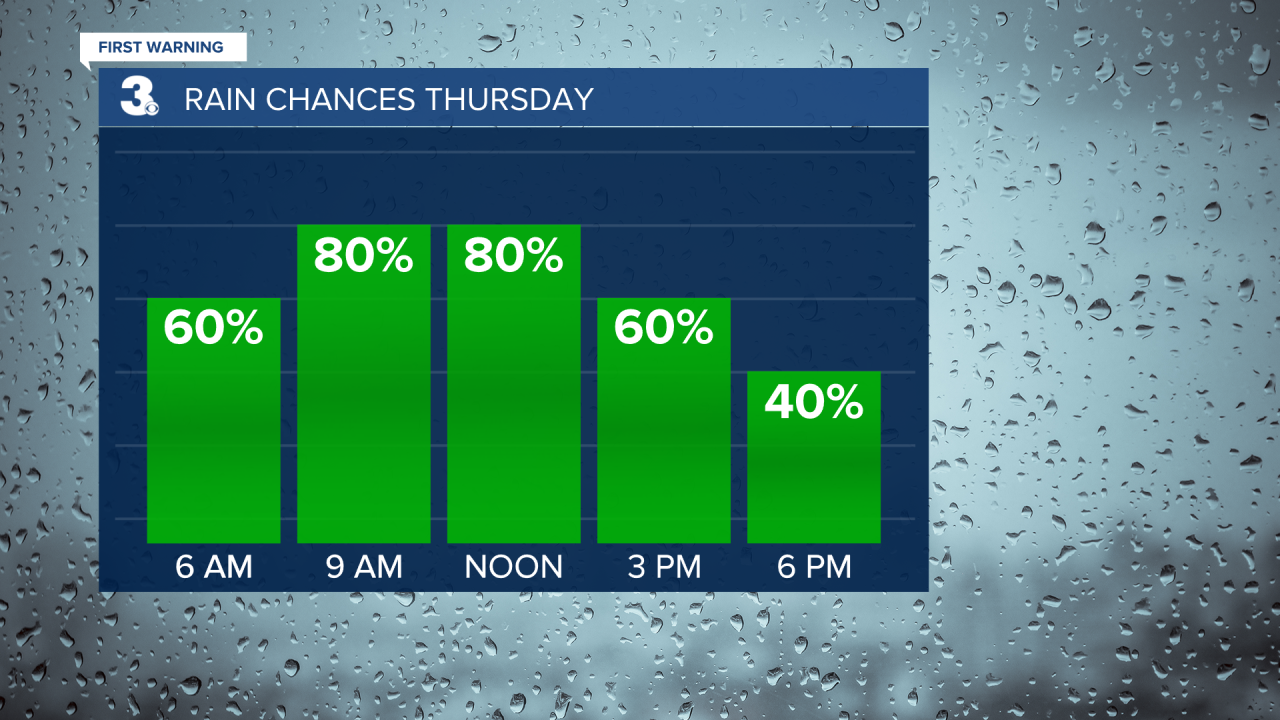
Rain will become more widespread with a chance for storms on Thursday as a cold front slides through the region. Expect mostly cloudy skies tomorrow with on and off showers. Rain could be heavy at times with an isolated thunderstorm possible. Temperatures will drop from the 60s to the 50s through the day.
Friday looks nice. We will return to sunshine with highs near 70 and a light wind. We will warm back to the upper 70s and low 80s this weekend.
Today: Mix of Clouds, Scattered Showers. Highs near 80. Winds: SW 10-20
Tonight: Building Clouds. Lows in the mid 60s. Winds: SW 5-15
Tomorrow: Mostly Cloudy, Rain & Storms. Temperatures falling into the 50s. Winds: N 5-15
Weather & Health
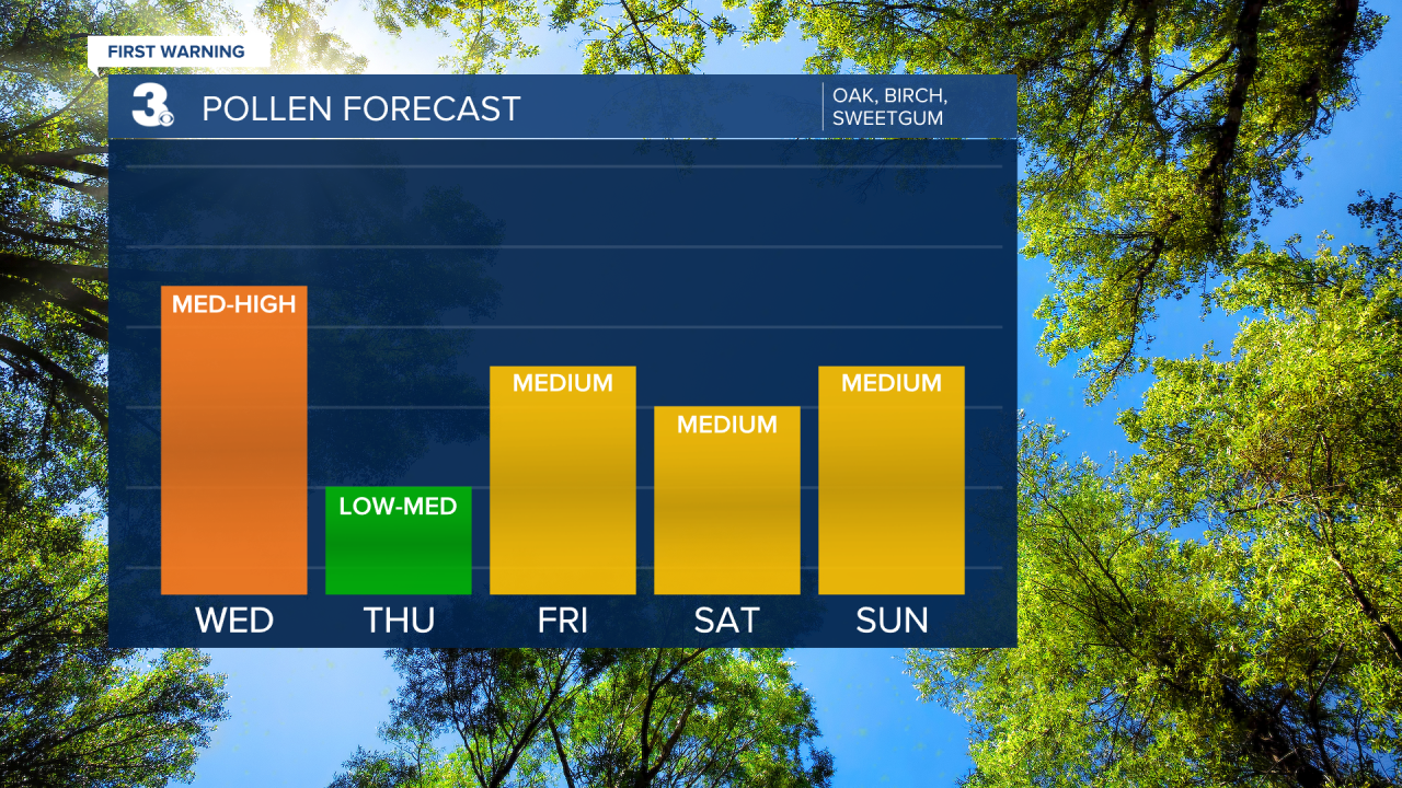
Pollen: Mod-High (Oak, Birch, Sweetgum)
UV Index: 2 (Low)
Air Quality: Good (Code Green)
Mosquitoes: High
Weather updates on social media:
Facebook: MylesHendersonWTKR
Instagram: @MylesHendersonWTKR
