


Meteorologist Myles Henderson’s First Warning Forecast
A gloomy start to the week. Windy through midweek. A stretch of below normal days with falling humidity.
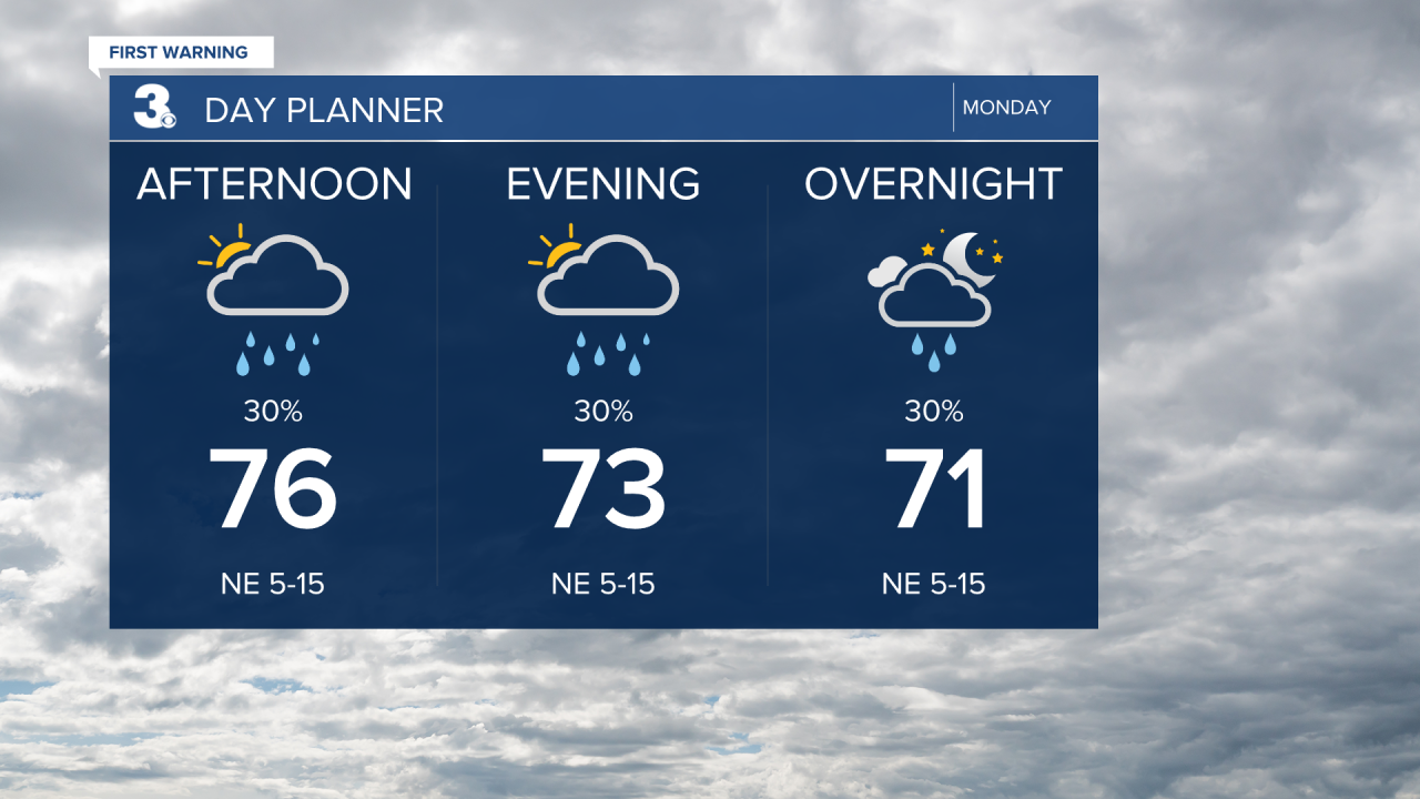
We will start the week with mostly cloudy skies and scattered showers as a stationary front lingers along the coast and Imelda skirts just off of the southern East Coast. Expect a few scattered showers today with areas of drizzle mixed in with the clouds. Highs will reach the mid 70s and the wind will begin to pick up.
Another gloomy day tomorrow with mostly cloudy skies, scattered showers, and drizzle. Highs will return to the mid 70s. It will be windy tomorrow with a NE wind at 10 to 20 and gusts to 30 mph.
Look for clearing skies on Wednesday. Highs will dip to low 70s and the humidity will start to fall. It will still be windy with gusts to 35 mph.
Expect a nice mix of sun and clouds with highs in the low 70s to end the work week.

Today: Scattered Showers. Highs in the mid 70s. Winds: NE 5-15
Tonight: Scattered Showers. Lows near 70. Winds: NE 10-15
Tomorrow: Scattered Showers. Highs in the mid 70s. Winds: NE 10-20 G30
Weather & Health
Pollen: Low (Ragweed)
UV Index: 4 (Medium)
Air Quality: Good (Code Green)
Mosquitoes: Extreme
Tropical Update
Hurricane Humberto to bring dangerous surf to most of the East Coast. On the forecast track, the center of Humberto will pass well west, and then north of Bermuda on Tuesday and Wednesday.
Maximum sustained winds are near 145 mph with higher gusts. Humberto is a category 4 hurricane on the Saffir-Simpson Hurricane Wind Scale.

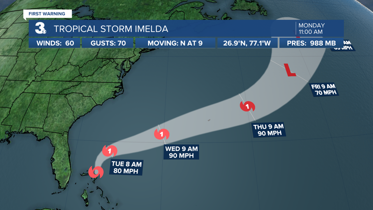
Tropical Storm Imelda moving north over the Bahamas. On the forecast track, the center of the system is expected to move across the northwestern Bahamas today and then turn ENE, moving away from the southeastern U.S. by the middle part of this week.
Maximum sustained winds have increased to near 60 mph with higher gusts. Additional strengthening is forecast, and Imelda is forecast to become a hurricane on Tuesday.
Weather updates on social media:
Facebook: MylesHendersonWTKR
Instagram: @MylesHendersonWTKR
