


Meteorologist Myles Henderson’s First Warning Forecast
Much cooler for Thanksgiving. Even cooler to end the week.
Highs will only reach the low 50s today, 20-degrees cooler than yesterday. We will see a nice mix of mostly sunny to partly cloudy skies. It will be a bit breezy with a NW wind at 5 to 15 mph. Lows will drop to near freezing overnight with a wind chill in the 20s.

Even cooler air moves in for Friday. Highs will only reach the mid 40s but it will feel more like the 30s with a NW wind at 10 to 20 mph.
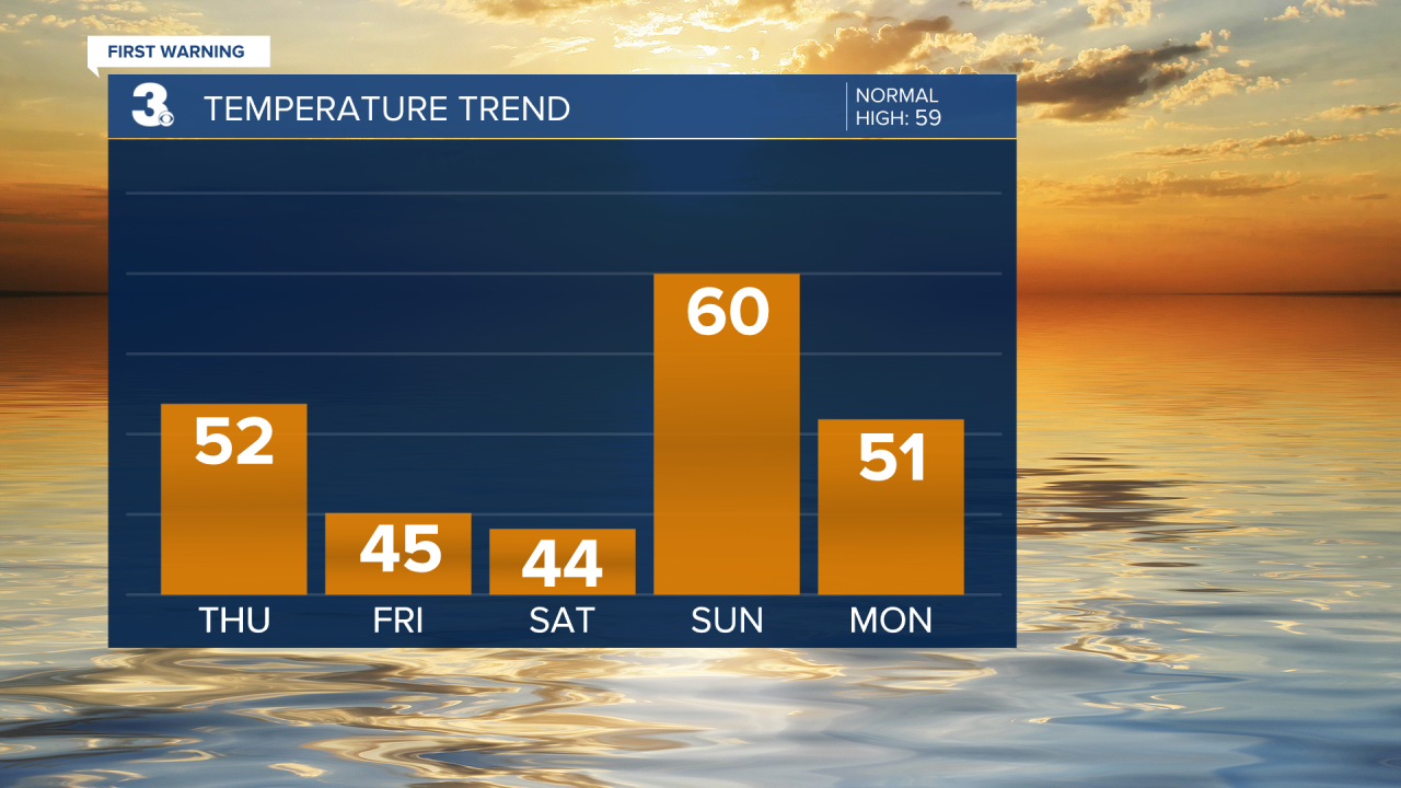
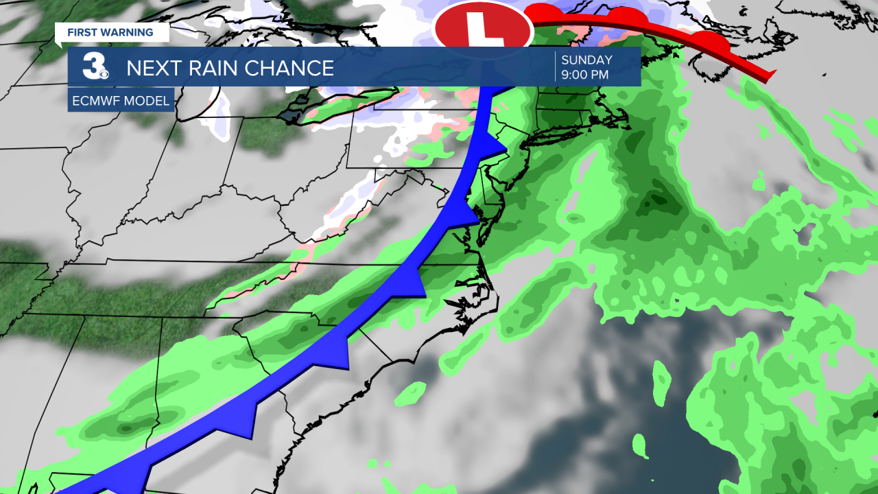
Highs will remain in the mid 40s with sunshine on Saturday. Highs will warm to near 60 on Sunday with clouds building in. Our next round of rain is set to move in Sunday night to Monday morning with a cold front.
Today: Sun & Clouds. Highs in the low 50s. Winds: NW 5-15
Tonight: Mainly Clear. Lows in the low 30s. Winds: NW 5-15
Tomorrow: Mostly Sunny. Highs in the mid 40s. Winds: NW 10-20
Weather & Health
Pollen: Low
UV Index: 3 (Moderate)
Air Quality: Good (Code Green)
Mosquitoes: Low
Tropical Update
No tropical activity at this time
Weather updates on social media:
Facebook: MylesHendersonWTKR
Instagram: @MylesHendersonWTKR
