

Chief Meteorologist Patrick Rockey’s First Warning Forecast
Expect a steamy and stormy first week in August. And don’t count on many thunderstorms to help cool things off.
The next few days will be very hot and very muggy, with high temperatures in the low to mid 90s and feels like temperatures close to 105°.
On Thursday we may even hit a heat index of 110°.

With that much heat and humidity in the atmosphere, we can never rule out a pop-up thunderstorm. But we do not expect any organized storms until at least Friday.
Before then we are only giving it a 20% chance for storms each afternoon.
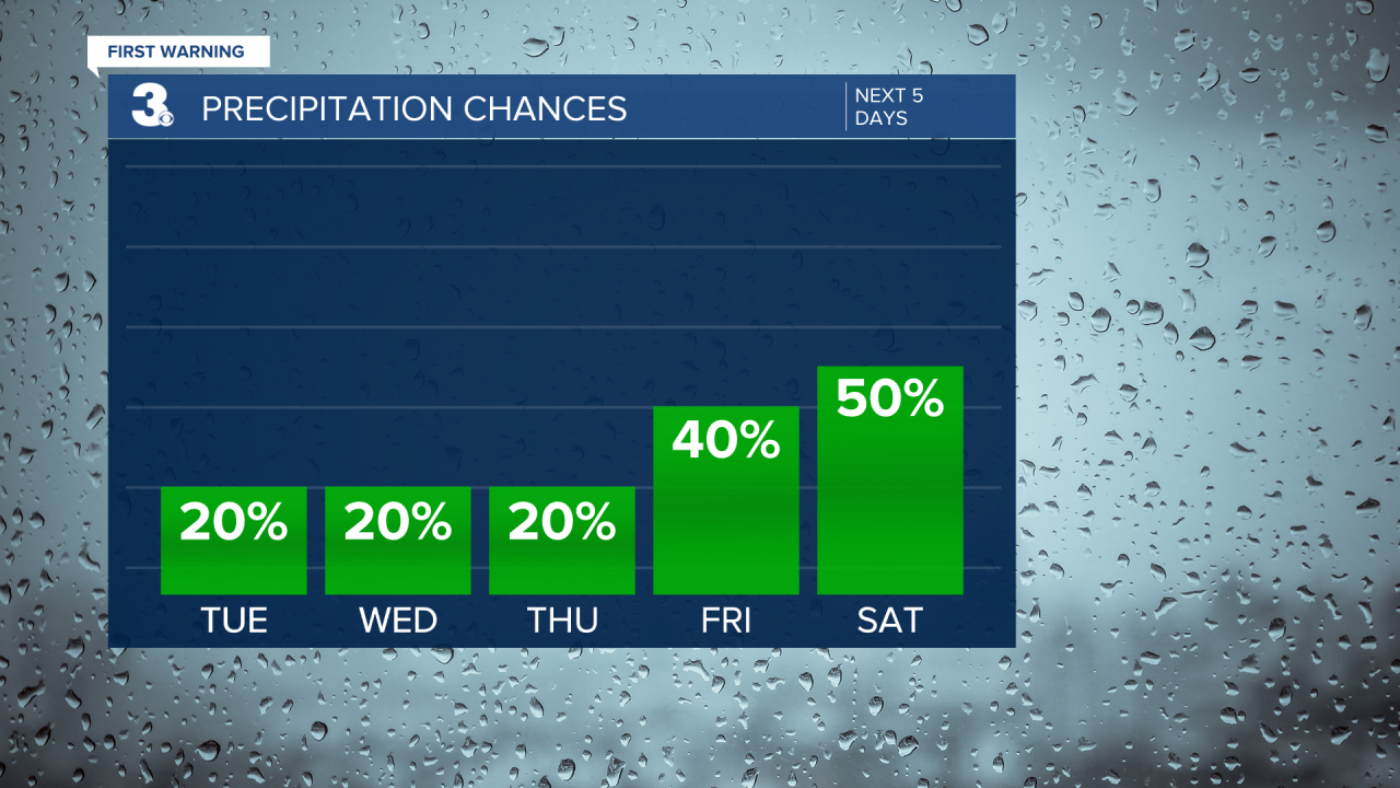
By Friday, a cold front will approach the region. That will help spark a good chance for showers and thunderstorms and a one-day drop in temperatures on Saturday.
You won’t exactly need to break out the winter coat, but we are expecting high temperatures on Saturday only in the upper 80s for most of us.
But by the second half of the weekend and the start of the work week temperatures are back in the low to mid 90s.

And it looks like that is a sign of things to come. A longer range forecast from the Climate Prediction Center tells us that we can expect warmer-than-normal conditions for the month of August.
