




Meteorologist Myles Henderson’s First Warning Forecast
Warming to the 80s and building humidity this week. Rain returns for the weekend.
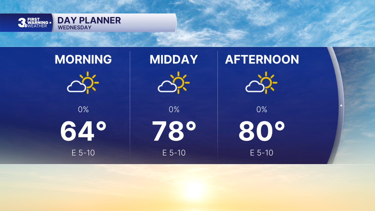
Another nice day today with a bit more sunshine. Highs will warm to near 80, slightly above normal for this time of year.
The warming trend continues with highs in the mid 80s Thursday and upper 80s Friday. With the building humidity, it will feel more like the 90s.
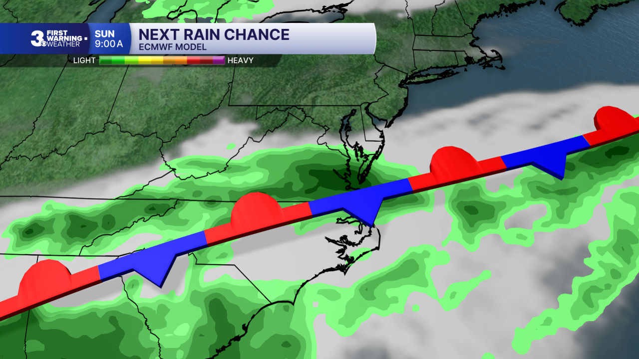
Rain chances return for the weekend as a cold front moves in and stalls out over the region. Scattered showers will build in on Saturday with a bigger rain chance for Sunday. Highs will drop back to the 70s for the weekend, behind the front.
Today: A Few Clouds. Highs near 80. Winds: E 5-10
Tonight: A Few Clouds. Lows in the mid 60s. Winds: S 5-10
Tomorrow: A Few Clouds. Highs in the mid 80s. Winds: SW 5-10
Weather & Health
Pollen: Low-Medium (Ragweed)
UV Index: 6 (Medium)
Air Quality: Good (Code Green)
Mosquitoes: High
Tropical Update
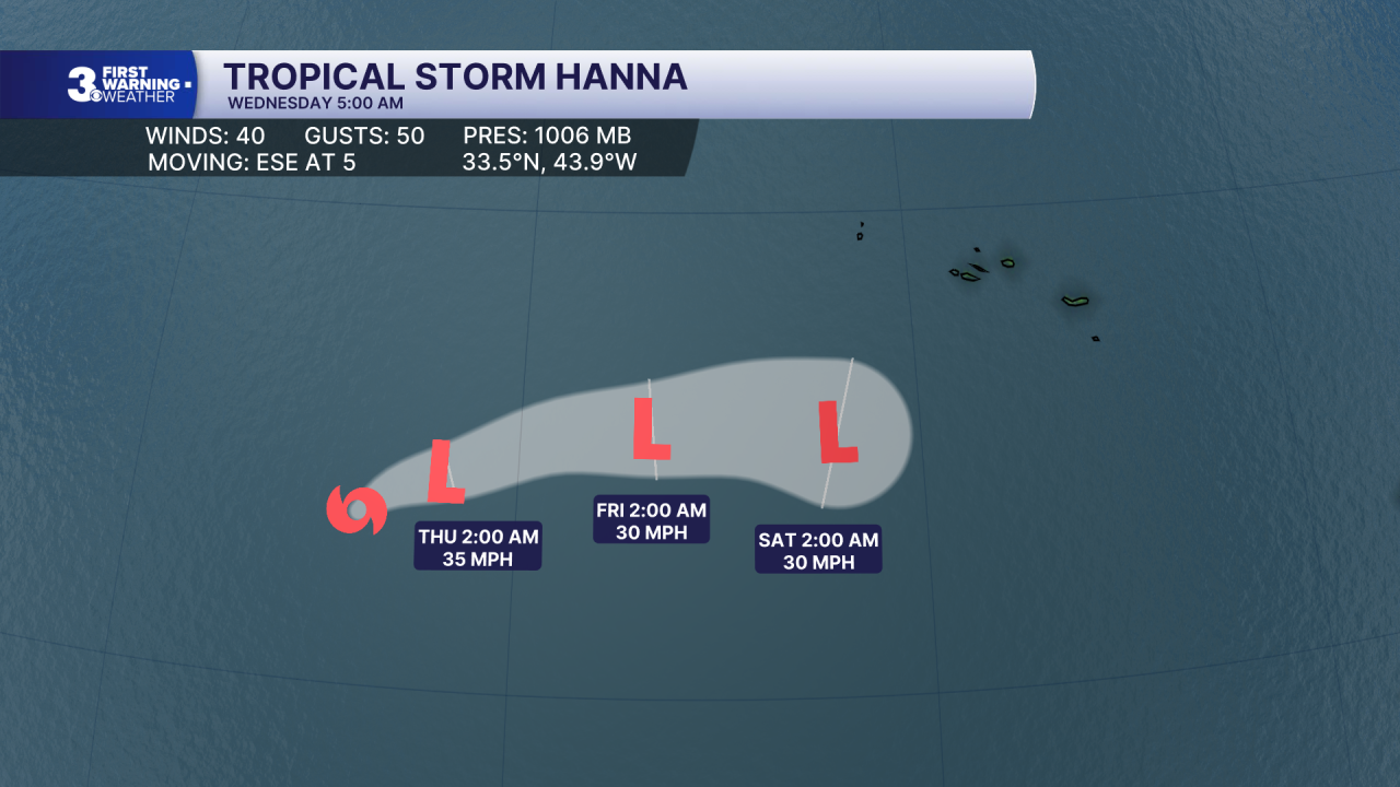
Tropical Storm Hanna moving SE over the open Atlantic. Maximum sustained winds remain near 40 mph with higher gusts. Gradual weakening is expected during the next couple of days, and Hanna is likely to become a post-tropical cyclone tonight or Thursday.
Weather updates on social media:
Facebook: MylesHendersonWTKR
Instagram: @MylesHendersonWTKR
X (Twitter): @MHendersonWTKR
Weather updates on social media:
Facebook: MylesHendersonWTKR
Instagram: @MylesHendersonWTKR
