




Meteorologist Myles Henderson’s First Warning Forecast
Warm and muggy to start the week but feeling more fall-like to end the week. A soggy stretch through midweek. A coastal low brings wind and flooding for the second half of the week.
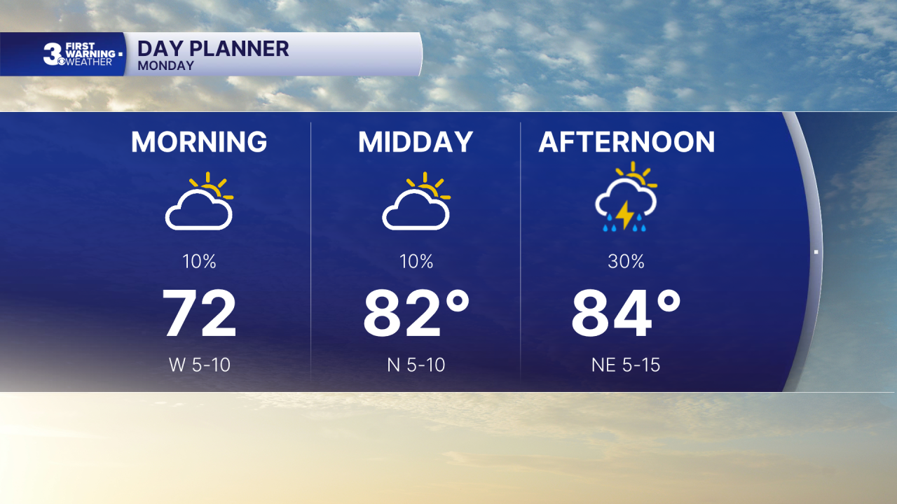
Still warm and muggy today with highs in the mid 80s. Look for building clouds today from partly to mostly cloudy skies. A scattered shower/storm is possible, mainly this afternoon to evening.
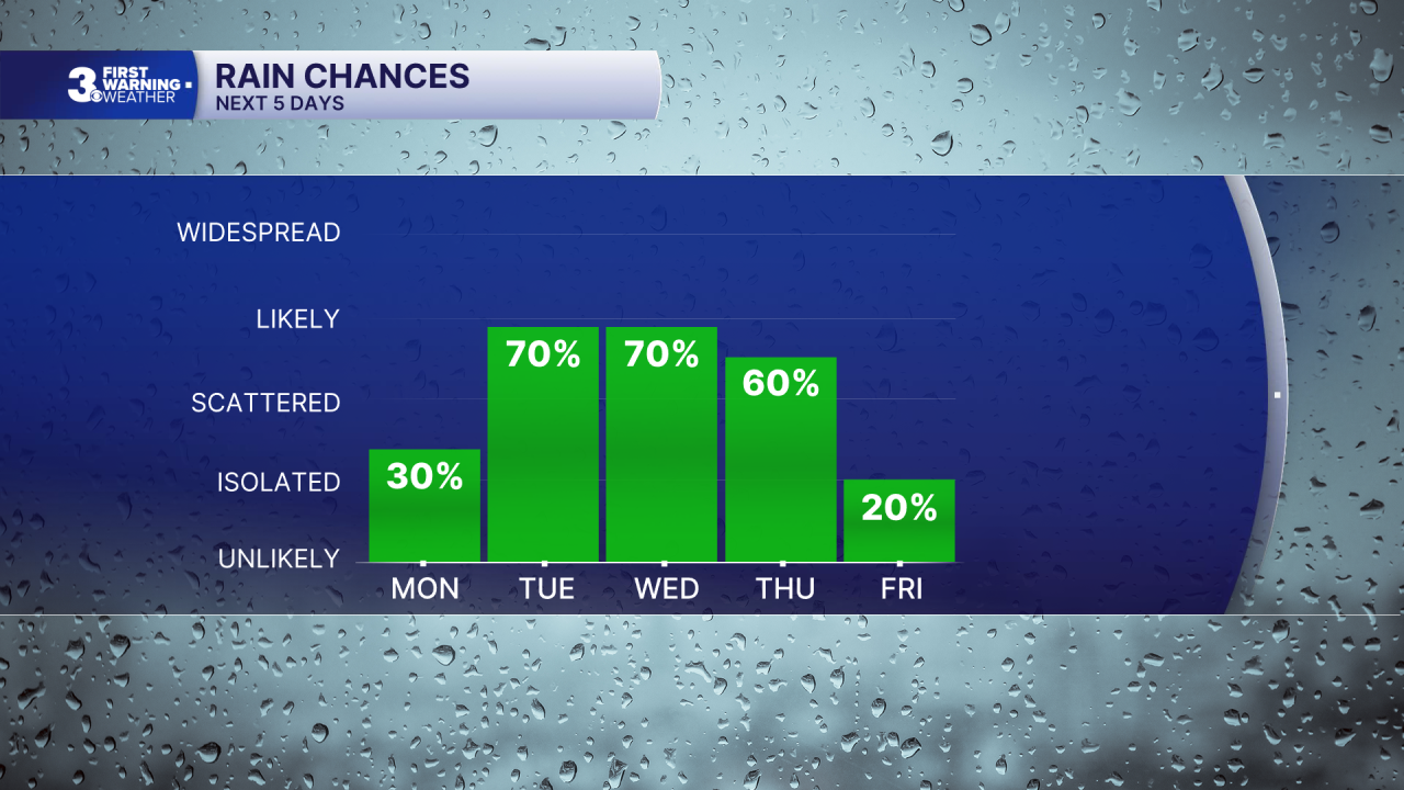
Get ready for a soggy stretch through midweek as a front stalls out over the region. Expect mostly cloudy skies with showers and storms Tuesday, Wednesday, and Thursday. Rain could be heavy at times with localized flooding possible.
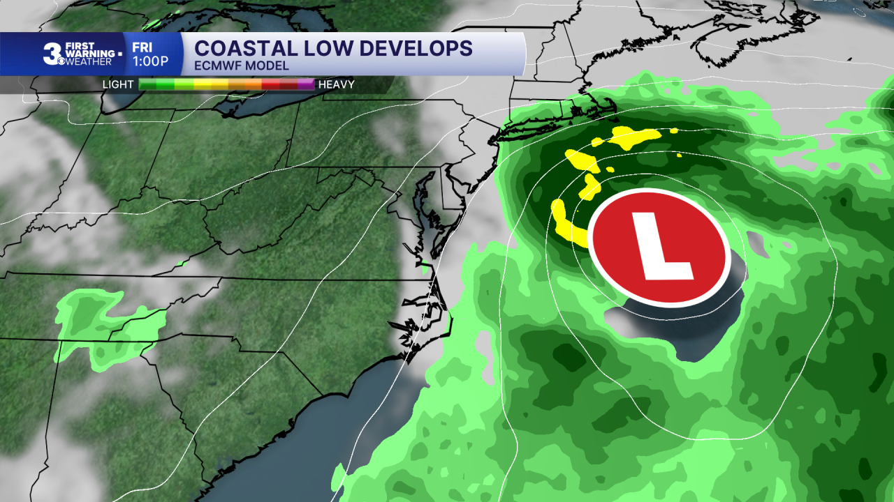
A coastal storm spins up for the second half of the week. Expect strong winds with gusts to 40+ mph possible. The strong NE winds will trigger some coastal flooding beginning on Wednesday.
Conditions should improve for the weekend with highs in the 70s and lower humidity.
Today: Partly Cloudy. Highs in the mid 80s. Winds: W/N/E 5-15
Tonight: Mostly Cloudy. Lows in the low 70s. Winds: E 5-10
Tomorrow: Mostly Cloudy, Rain. Highs near 80. Winds: E 5-15
Weather & Health
Pollen: Medium (Ragweed)
UV Index: 7 (High)
Air Quality: Good (Code Green)
Mosquitoes: Extreme
Tropical Update
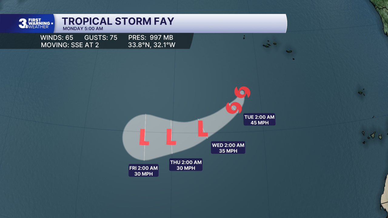
Tropical Storm Fay is centered about 405 miles SW of the Azores. A faster motion to the southwest is anticipated during the next few days. Maximum sustained winds have decreased to near 65 mph with higher gusts. Continued weakening is forecast, and Fay could degenerate to a post-tropical cyclone in a day or two.
Weather updates on social media:
Facebook: MylesHendersonWTKR
Instagram: @MylesHendersonWTKR
