


Meteorologist Myles Henderson’s First Warning Forecast
A warming trend to end the week with highs near 90 by Friday. Tracking our next chance for rain moving in later Sunday.
Highs will reach the upper 70s today, about 10 degrees warmer than yesterday. Expect mostly sunny skies with a bit of a NE breeze, but not as strong as yesterday.

Lots of sunshine tomorrow with highs in the low 80s, near normal for this time of year. Expect a big step warmer on Friday with highs near 90.
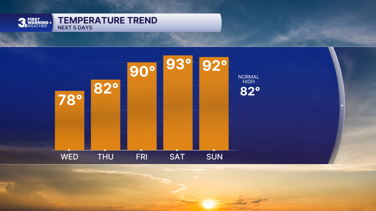
The hot air sticks around for the weekend with highs in the low to mid 90s. We will see partly cloudy skies through most of the weekend. Our next chance for rain is set to move in later Sunday with a cold front.

Today: Mostly Sunny. Highs in the upper 70s. Winds: NE 5-15
Tonight: Mainly Clear. Lows in the upper 50s. Winds: E/S 5-10
Tomorrow: Mostly Sunny. Highs in the low 80s. Winds: N/E 5-10
Weather & Health
Pollen: Moderate (Trees & Grasses)
UV Index: 8 (High)
Air Quality: Good (Code Green)
Mosquitoes: High
Tropical Update
No tropical activity at this time
Weather updates on social media:
Facebook: MylesHendersonWTKR
Instagram: @MylesHendersonWTKR
