


Meteorologist Myles Henderson’s First Warning Forecast
Warming to the 50s for midweek. Tracking rain/snow showers early Thursday. Sunshine and chilly to end the work week.
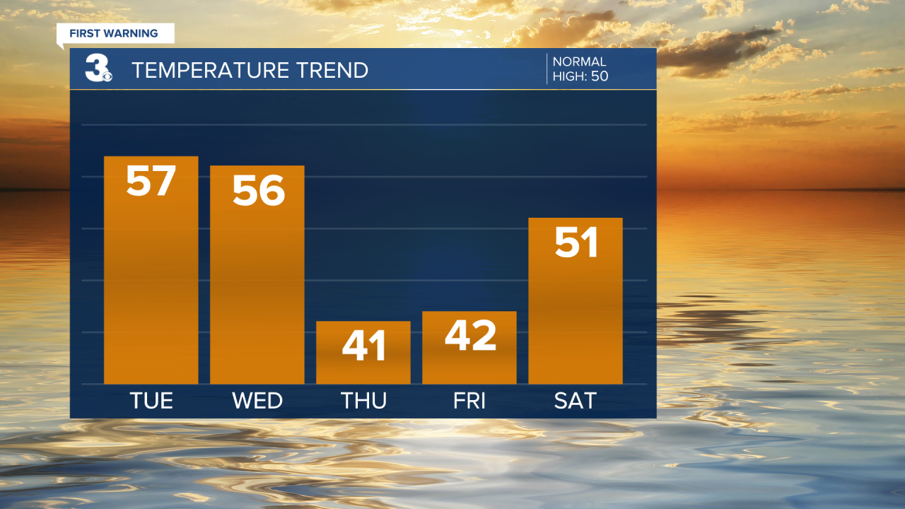
Another chilly start with temperatures in the 20s and 30s this morning. We will see lots of sunshine again today with highs warming to the upper 50s, almost 10 degrees warmer than yesterday.

Clouds will build in on Wednesday (partly to mostly cloudy skies) with highs in the mid 50s. A few showers are possible Wednesday night.
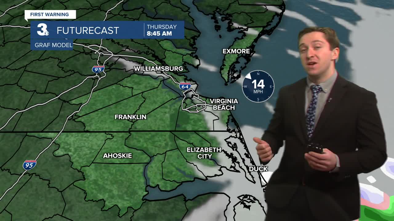
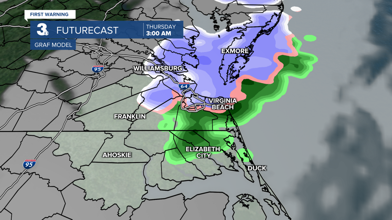
Rain/snow showers are possible early Thursday morning. Little to no snow accumulation is expected (0” to 0.5”). It will be chilly and windy on Thursday with highs in the low 40s and winds gusting 20 to 30 mph.
Expect sunshine on Friday, but still chilly with highs in the low 40s.
Today: Mostly Sunny. Highs upper 50s. Winds: SW 5-15
Tonight: Mainly Clear. Lows in the upper 30s. Winds: SW 5-10
Tomorrow: Building Clouds. Highs in the mid 50s. Winds: SW 10-15
Weather updates on social media:
Facebook: MylesHendersonWTKR
Instagram: @MylesHendersonWTKR
