


Meteorologist Myles Henderson’s First Warning Forecast
A step warmer today with highs near 50. Falling back to the 40s to end the work week.
Temperatures will start in the 20s and 30s this morning, so there is still a risk for icy spots left behind from the snow melt. We will see a mix of partly to mostly cloudy skies today. Highs will climb to near 50, warmer than yesterday but still below normal for this time of year. It will be windy today with a SW wind at 10 to 20 and higher gusts.

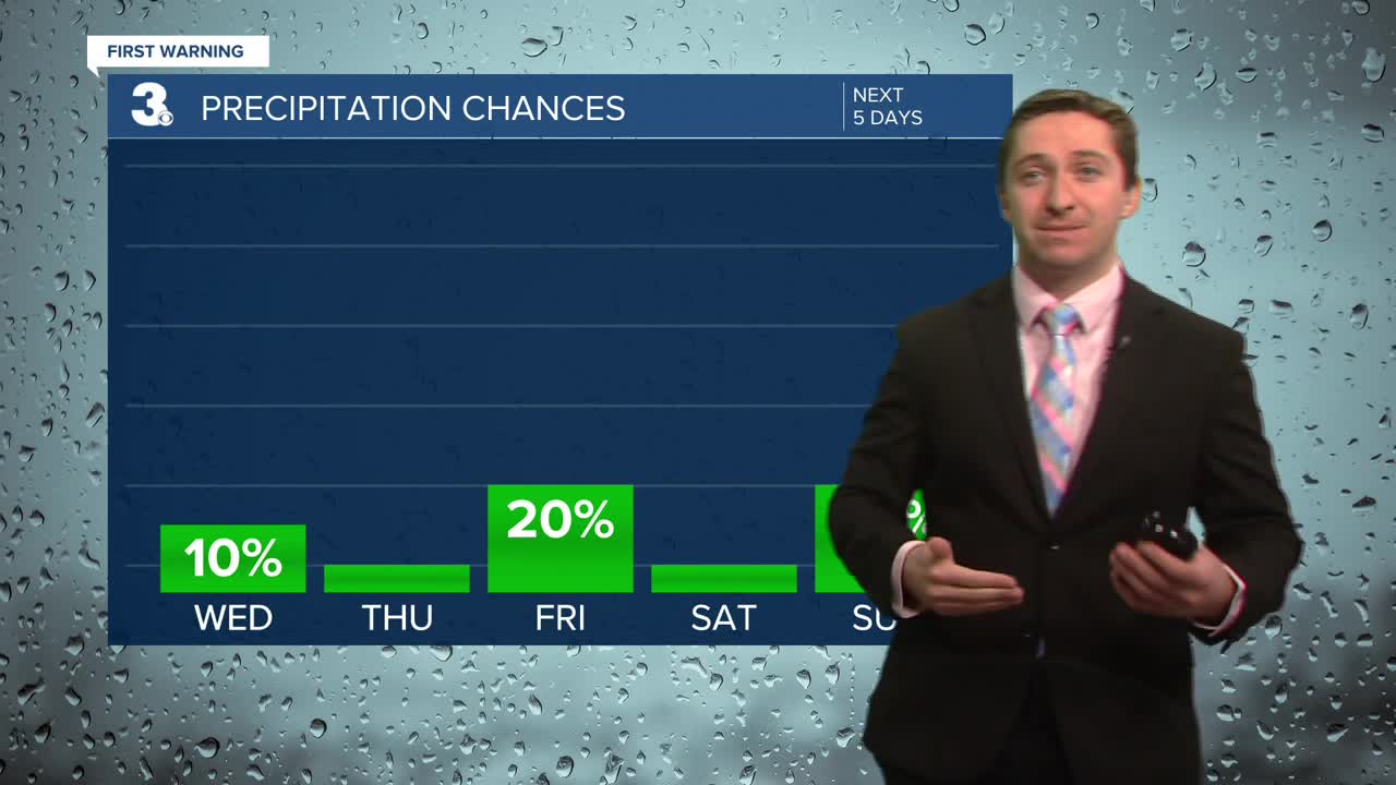
The colder air returns to end the week. Highs will drop to the mid 40s on Thursday. We will see more sunshine and it will still be breezy. Highs will stay in the mid 40s for Friday with partly to mostly cloudy skies and a few spotty showers possible.

The weekend looks nice, but still cool. Highs will sneak into the 50s on Saturday but fall back to the 40s on Sunday. Expect mostly sunny skies on Saturday. More clouds will build in Sunday as a cold front moves in. A spotty shower is possible.
Even colder air is set to move in early next week, behind the cold front. Highs will drop to the mid 30s on Monday.

Today: Mix of Clouds, Windy. Highs near 50. Winds: SW 10-20
Tonight: Partly Cloudy. Lows in the mid 30s. Winds: W 10-15
Tomorrow: Mostly Sunny. Highs in the mid 40s. Winds: NW 10-15
Weather updates on social media:
Facebook: MylesHendersonWTKR
Instagram: @MylesHendersonWTKR
