


Meteorologist Myles Henderson’s First Warning Forecast
A very warm end to the work week. Rain returns on Friday. Showers, windy, and much cooler this weekend.
We will warm to the mid 60s this afternoon, about 15 degrees above normal for this time of year. Expect a nice mix of sun and clouds today with light winds. Thursday will be the warmest day of the week with highs climbing to near 70. We will see clouds building in tomorrow from partly to mostly cloudy. A stray shower is possible, but most areas will stay dry.
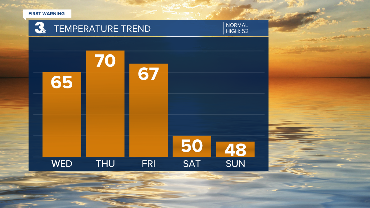
Rain starts to build in on Friday. A few showers are possible in the morning, but rain is more likely in the afternoon to evening as a cold front pushes through. Highs will reach the mid to upper 60s on Friday.
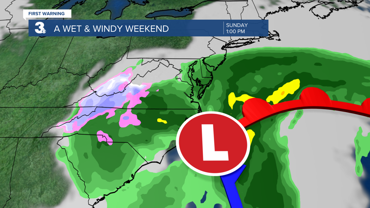
Get ready for a messy weekend with rain, wind, and colder temperatures. Highs will drop to near 50 on Saturday and the upper 40s on Sunday. Rain is likely both days as an area of low pressure slides up the East Coast. It will be windy all weekend with N/NE winds at 10 to 20 and gusts to near 30 mph.
Today: Partly Cloudy. Highs in the mid 60s. Winds: W/N/E 5-10
Tonight: Partly Cloudy. Lows in the mid 40s. Winds: E 5-10
Tomorrow: Building Clouds. Highs near 70. Winds: S 5-15
Weather updates on social media:
Facebook: MylesHendersonWTKR
Twitter: @MHendersonWTKR
Instagram: @MylesHendersonWTKR
