


Meteorologist Myles Henderson’s First Warning Forecast
Back to the heat and humidity this week. Highs in the 90s, feeling like the triple digits.
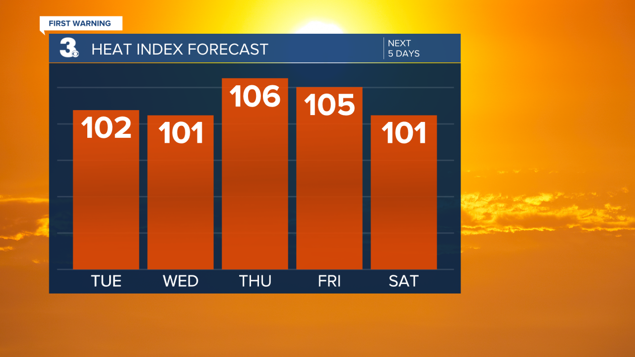
Highs will warm to the mid 90s today, about 5 degrees warmer than yesterday. The afternoon heat index will reach 100 to 105. Expect mostly sunny skies this morning with partly cloudy skies this afternoon. A “pop-up” shower or storm is possible this afternoon to evening.

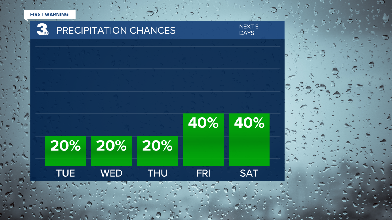
Most of the work week will be typical summer days. Highs will reach the low to mid 90s with afternoon heat index values in the triple digits (100 to 105). We will see a mix of mostly sunny to partly cloudy skies with an isolated shower or storm possible each day (20% chance).
Rain and storm chances will increase slightly for Friday and the weekend (30-40% chances). Highs will remain in the low 90s this weekend and it will still be humid.
Today: Mostly Sunny to Partly Cloudy. Highs in the mid 90s. Winds: SW/W 5-10
Tonight: Partly Cloudy. Lows in the mid 70s. Winds: W/N 5-10
Tomorrow: Mostly Sunny to Partly Cloudy. Highs in the low 90s. Winds: N/E 5-10
Weather & Health
Pollen: Medium-High (Grasses)
UV Index: 10 (Very High)
Air Quality: Good (Code Green)
Mosquitoes: Extreme
Tropical Update
No tropical activity at this time
Weather updates on social media:
Facebook: MylesHendersonWTKR
Twitter: @MHendersonWTKR
Instagram: @MylesHendersonWTKR
