


Chief Meteorologist Patrick Rockey’s First Warning Forecast
*** Winter Storm Watch for all of southeast Virginia and most of northeast North Carolina from Friday evening to Saturday afternoon. Snow accumulation of 3" to 6" possible with locally higher amounts. Winds could gust as high as 45 mph.
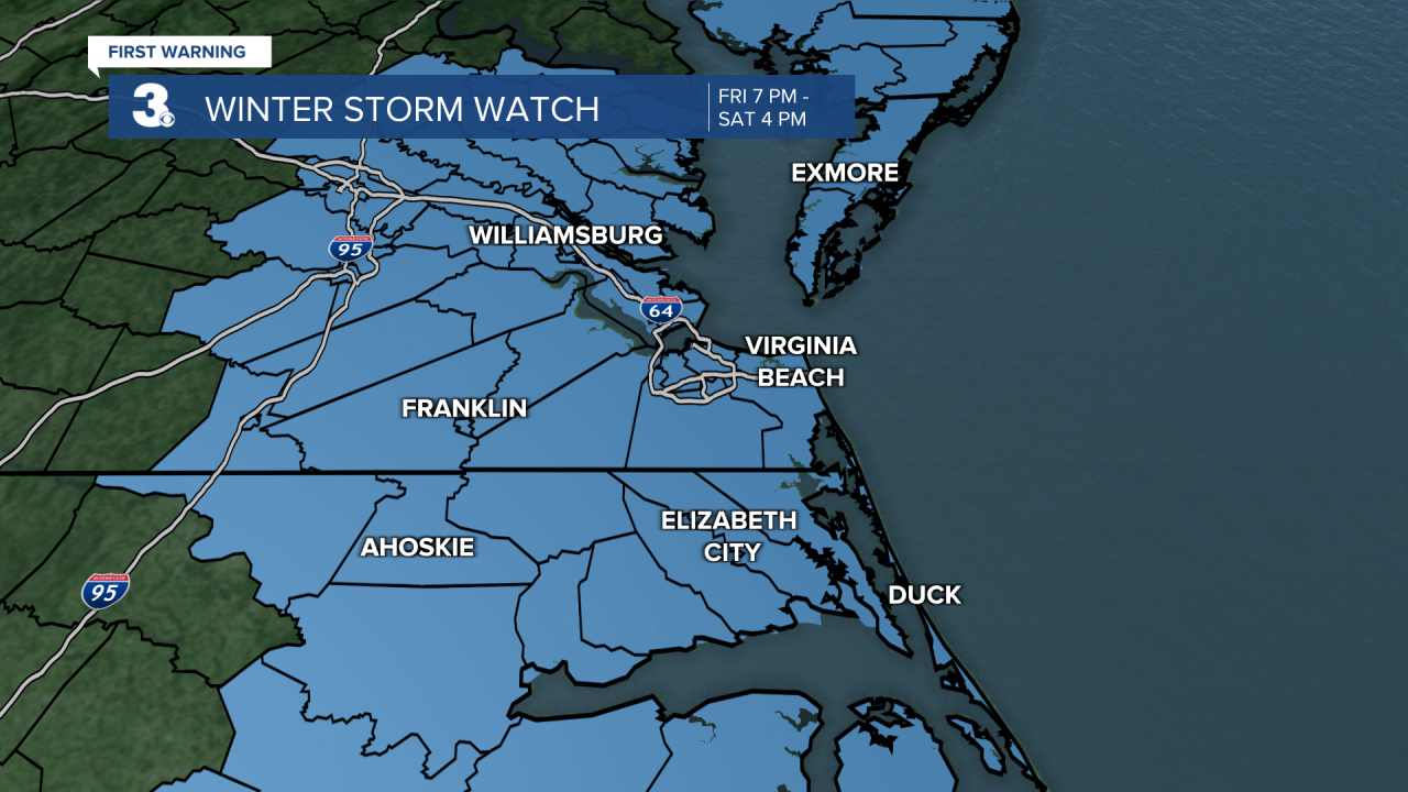
An area of low pressure from down south and a cold front from the north will converge on our region, bringing more snowy weather.
Scattered rain showers are possible late Friday afternoon and into the evening. As temperatures drop Friday night, rain will change over to snow. Expect widespread snow overnight as winds ramp up.

Snow will continue for Saturday morning, tapering off from west to east in the early afternoon. Most of the area will see 2” to 5” of accumulation with higher totals possible (especially on the Eastern Shore). It will be very windy on Saturday, north to NW at 20 to 30 with gusts to 40+ mph. We could see some coastal/tidal flooding on Saturday morning, mainly between 6-8 am.
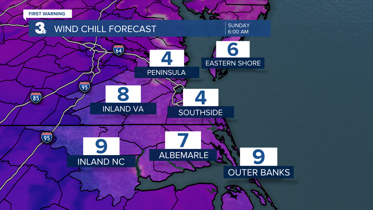
Temperatures will drop to the teens Sunday morning with wind chill values in the single digits, possibly even below zero at some points. Winds will relax on Sunday with more sunshine and highs in the mid 30s.
But it wouldn't be Hampton Roads weather without big temperature swings. Expect a big warm up next week with high temperatures in the 60s!
Chief Meteorologist Patrick Rockey
