


Meteorologist Myles Henderson’s First Warning Forecast
Another round of showers and storms. Still hot and humid this week with several days in the 80s to near 90.
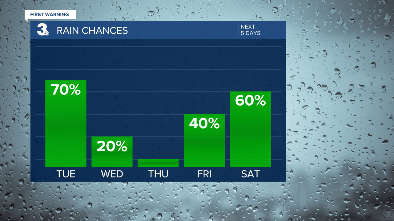
We will see a mix of clouds today with spotty showers. Highs will reach the mid 80s and it will still be humid.

A bigger chance for rain and storms will move in this evening. Strong to severe storms are possible with the potential for damaging wind gusts and localized flooding.

Lower rain chances and more sunshine for the second half of the workweek. It will still be hot and humid with highs in the upper 80s to low 90s.
Showers and storms return for Friday and the weekend. The warm and muggy conditions linger for the weekend with highs in the mid to upper 80s.
Today: Mix of Clouds, Spotty Showers. Highs in the mid 80s. Winds: SW 10-15
Tonight: Showers & Storms. Lows in the low 70s. Winds: SW 5-10
Tomorrow: Partly Cloudy. Highs in the upper 80s. Winds: N/E 5-10
Weather & Health
Pollen: Low (Grasses)
UV Index: 7 (High)
Air Quality: Good (Code Green)
Mosquitoes: Extreme
Tropical Update
No tropical activity at this time
Weather updates on social media:
Facebook: MylesHendersonWTKR
Instagram: @MylesHendersonWTKR
