


Meteorologist Myles Henderson’s First Warning Forecast
Our hot, humid, and stormy stretch of days continues, including a risk for severe storms. Cooler and less humid air will move in to start next week.
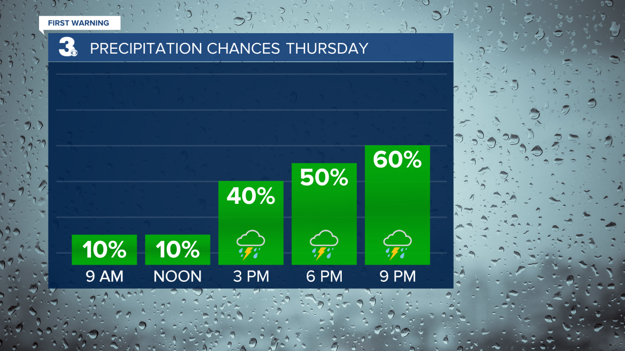
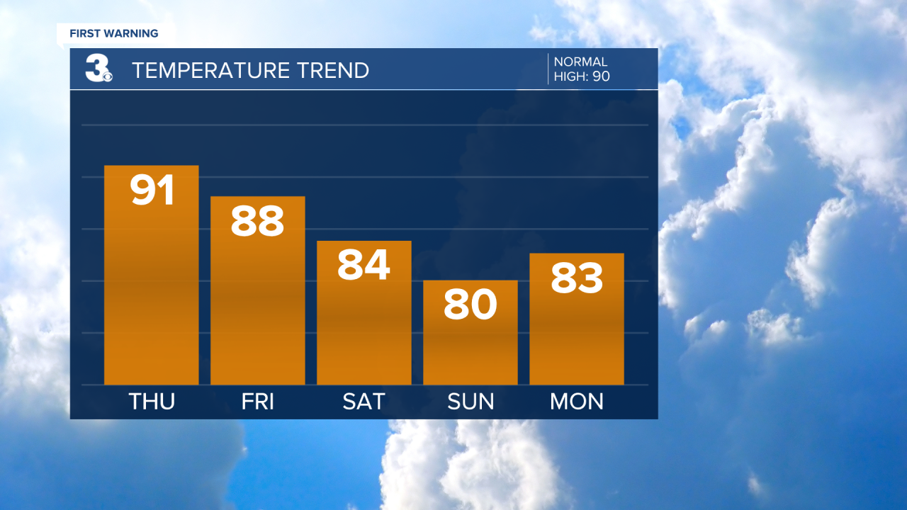
Highs will climb to the low 90s today with an afternoon heat index near 100. Expect a mix of partly to mostly cloudy skies with showers and storms moving in this afternoon to evening. Some storms could be strong to severe with damaging wind gusts and localized flooding.
More of the same for Friday with highs in the upper 80s. We will see a mix of clouds with scattered showers and storms Friday afternoon to evening and another threat for severe storms.
An approaching cold front will break us out of this unsettled pattern this weekend. Expect scattered showers and storms Saturday but clearing skies on Sunday. Highs will drop to the low and mid 80s and the humidity will drop Sunday to Monday.
Today: Mix of Clouds, PM Storms. Highs in the low 90s. Winds: SW/N 5-10
Tonight: Scattered Storms, Severe Threat. Lows in the mid 70s. Winds: NW 5-10
Tomorrow: Mix of Clouds, PM Storms. Highs in the upper 80s. Winds: N/E 5-10
Weather & Health
Pollen: Low-Medium (Grasses)
UV Index: 9 (Very High)
Air Quality: Good (Code Green)
Mosquitoes: Extreme
Tropical Update
No tropical activity at this time.
Weather updates on social media:
Facebook: MylesHendersonWTKR
Twitter: @MHendersonWTKR
Instagram: @MylesHendersonWTKR
