


Meteorologist Myles Henderson’s First Warning Forecast
Another step warmer to end the week. Tracking a line of showers tonight. Climbing to the 70s this weekend.
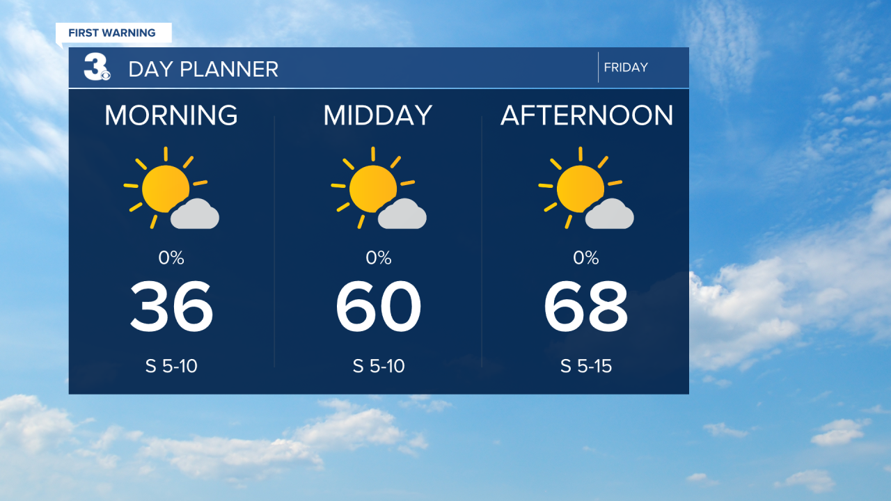
Another chilly start with temperatures in the 30s this morning. We will warm to the upper 60s today, warmer than yesterday and above normal for this time of year. Expect mostly sunny skies for most of the day with clouds building in late in the day. A line of showers will move through tonight between 9 PM and 3 AM.
The weekend forecast looks very nice. We will see mix of mostly sunny to partly cloudy skies on Saturday with highs in the mid to upper 60s. Sunday will be warmer with highs in the upper 70s.
Rain chances will return for Monday as a cold front moves through the region. Highs will drop from near 70 on Monday to near 50 on Tuesday, behind the front.

Today: Mostly Sunny. Highs in the upper 60s. Winds: S 5-10
Tonight: Scattered Showers. Lows in the low 50s. Winds: SW 5-15
Tomorrow: Mostly Sunny. Highs in the upper 60s. Winds: W/N/E 5-10
Weather & Health
Pollen: Medium-High (Juniper, Maple, Ash)
UV Index: 5 (Moderate)
Air Quality: Good (Code Green)
Mosquitoes: Low
Weather updates on social media:
Facebook: MylesHendersonWTKR
Instagram: @MylesHendersonWTKR
