


Meteorologist Myles Henderson’s First Warning Forecast
Tracking another round of severe storms today. More showers and storms this weekend. A chilly and windy Mother’s Day.
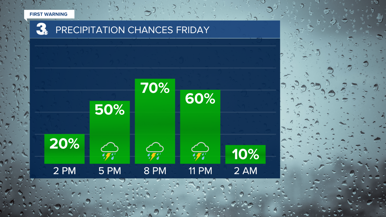
Another risk for severe thunderstorms today. The biggest chance for showers and storms will be after 4 PM and continue through this evening. Strong to severe storms are expected with a threat for damaging wind gusts, localized flooding, hail, and tornadoes.
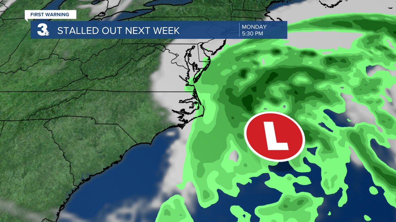
Showers and storms will continue this weekend as an area of low pressure tracks across the Mid-Atlantic. Expect mostly cloudy skies Saturday with scattered showers and storms throughout the day. Highs will reach the mid 70s. It will be chilly and windy on Sunday with highs in the upper 50s and a NNE wind gusting over 30 mph. We will still see mostly cloudy skies with scattered showers.

The chilly and windy weather will continue for early next week with highs in the low to mid 60s and strong N/NE winds. We will see a mix of clouds (partly to mostly cloudy) with scattered showers lingering, especially along the coast.
(With several days of strong N/NE winds, will likely see issues with tidal flooding starting Sunday into early next week.)
Today: Mostly Cloudy, PM Storms. Highs in the upper 70s. Winds: SE 5-15
Tonight: Showers & Storms. Lows in the mid 60s. Winds: S/SW 5-15
Tomorrow: Scattered Showers/Storms. Highs in the mid 70s. Winds: SW/N 5-15
Weather & Health
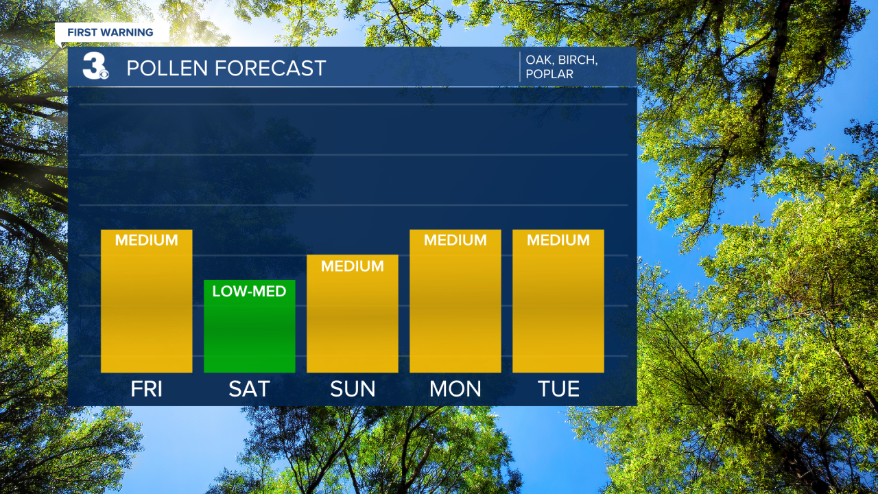
Pollen: Medium (Oak, Birch, Poplar)
UV Index: 4 (Moderate)
Air Quality: Good (Code Green)
Mosquitoes: Moderate
Weather updates on social media:
Facebook: MylesHendersonWTKR
Twitter: @MHendersonWTKR
Instagram: @MylesHendersonWTKR
