

Derrah Getter's First Warning Forecast
The cold continues, but warmer temperatures are finally in sight.
Thursday evening, the northerly winds cause temperatures to feel about 10 degrees colder. Lows tonight will be in the teens and 20s. The wind chill Friday morning will be in the single digits for most.

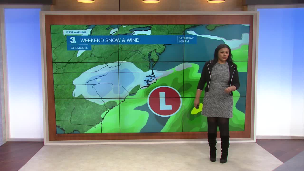
We stay dry and partly sunny through the first part of Friday. More clouds build in during the afternoon. Snow showers begin as soon as Saturday morning. Highs this weekend will be in the upper 20s. Due to the temperatures alone, we are looking at pure snow chances in coastal Virginia and North Carolina. The Outer Banks could see rain at time in the afternoon when temperatures try to sneak above freezing there, but we are anticipating mainly snow. In fact, the highest snowfall totals are forecast in northeast North Carolina.

Winds will be another component to the storm. Gusts up to 50 mph are forecast along the coast. This could lead to visibility issues in the way of blowing snow.

Sunday marks the first day of February but also a full moon. This will cause tidal flooding which will pose additional concerns on the roads.

We finally reach temperatures above freezing at the start of next week.

Let's connect on social media!
Forecaster Derrah Getter:
For weather updates on Facebook: HERE
For weather updates on X: HERE
Follow me on Instagram: HERE
Check out the Interactive Radar on WTKR.com: Interactive Radar
