


Derrah Getter's First Warning Forecast
We broke our 16-day dry streak today with 0.01 inches of rain measured at Norfolk International. The last time we saw rain was a trace amount on August 22.
This evening will be mostly cloudy with lingering showers. Lows tonight fall into the mid 60s.
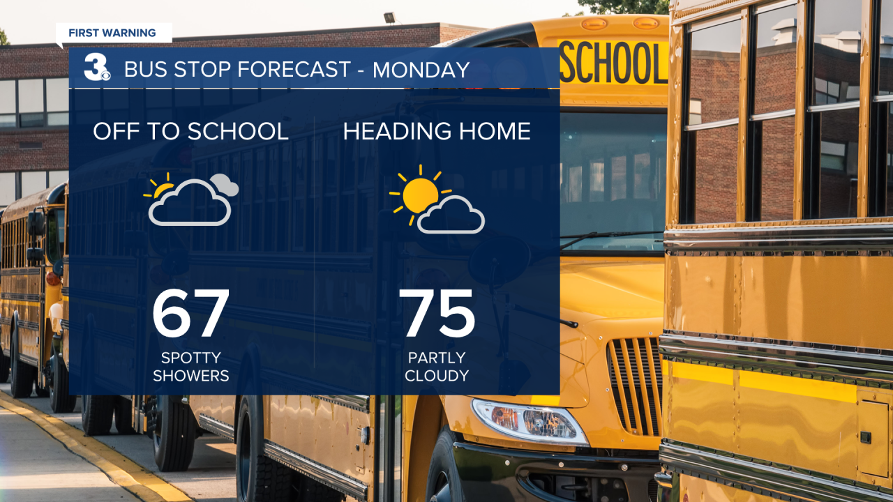
Clouds clear overnight for some, but a few spotty showers will still be possible early Monday morning. We'll see a mix of sun and clouds for the rest of the day as the front stalls off the Atlantic coast. High temperatures reach the mid 70s.

Northeasterly winds this week will bring minor tidal flooding concerns for several days. Isolated showers return during the middle of the week.
More sunshine returns later this week with drier and slightly warmer conditions heading into the upcoming weekend.

Let's connect on social media!
Forecaster Derrah Getter:
For weather updates on Facebook: HERE
For weather updates on X: HERE
Follow me on Instagram: HERE
Check out the Interactive Radar on WTKR.com: Interactive Radar
