



Derrah Getter's First Warning Forecast
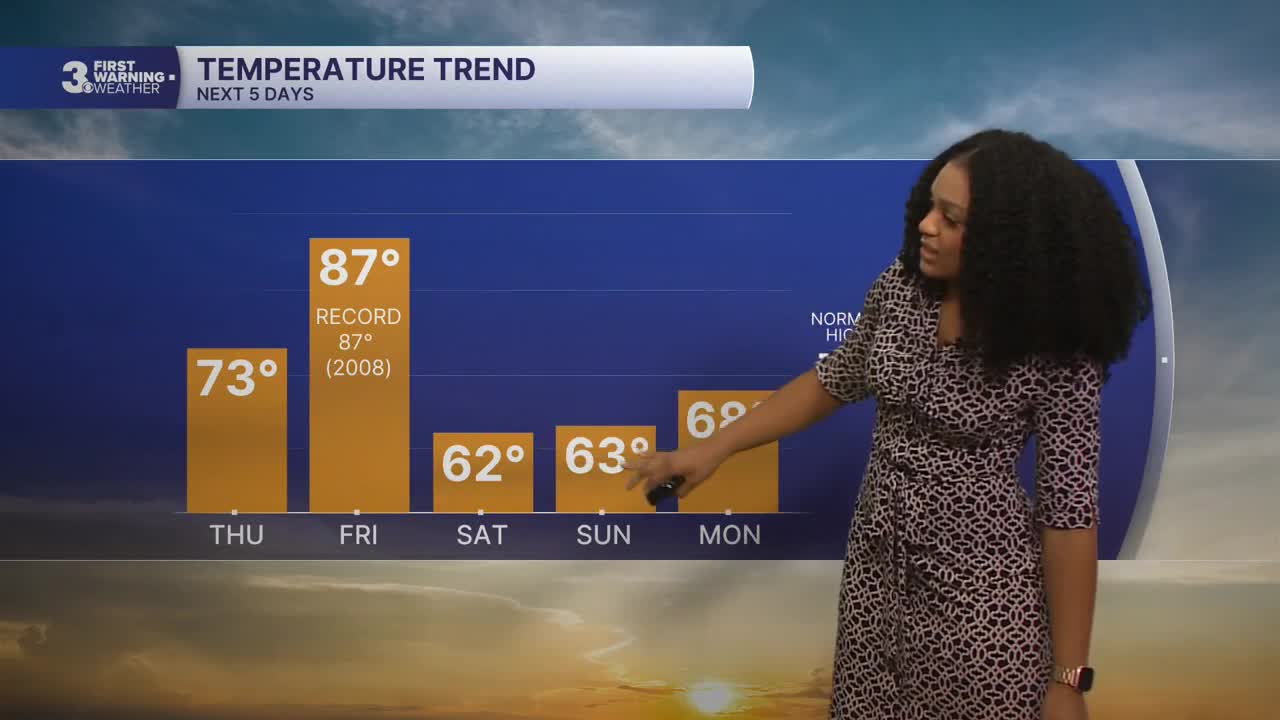
It is much cooler and cloudier Thursday. More sunshine and near-record high temps make a brief comeback Friday before an even bigger cool down moves in over the weekend.

Thursday afternoon will be partly to mostly cloudy. Isolated shower chances remain this evening as a cold front stalls out across the region.
As the front clears out, we'll see more sunshine on Friday afternoon. Highs will reach the upper 80s, and our records could be in jeopardy for the second time this week.

A stronger cold front moves in on Friday night. Rain chances increase early Saturday morning. We'll see some clearing by Saturday afternoon with much cooler temperatures. It will be breezy with northerly winds at 15-20 mph.
A coastal low could potentially form early next week, but the probability of local impacts appears low at this time.

Let's connect on social media!
Meteorologist Derrah Getter:
For weather updates on Facebook: HERE
For weather updates on X: HERE
Follow me on Instagram: HERE
Check out the Interactive Radar on WTKR.com: Interactive Radar
