


Derrah Getter's First Warning Forecast
We get a brief break from the rain before more returns this weekend.
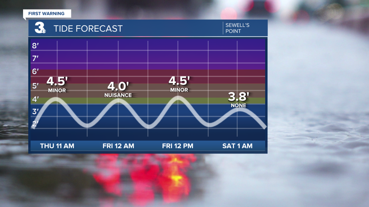
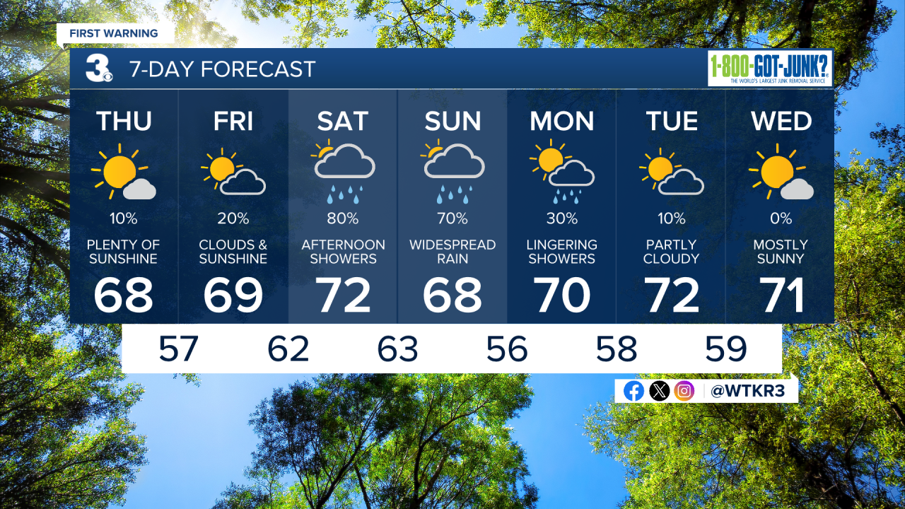
The skies will be much brighter today. Minor tidal flooding is forecast just before noon. High temperatures this afternoon will struggle to reach 70 degrees. Tonight, lows fall into the upper 50s.
The sunshine sticks around Friday. There will be a slight chance of a few spotty showers mainly along the Outer Banks. Highs will be near 70.

Widespread rainfall returns this weekend. Scattered showers begin moving in Saturday afternoon. The rain will continue through early Monday morning. This is all associated with the forecast development of a coastal low. Coastal and tidal flooding, and wind gusts around 50 mph will be some of our biggest impacts.
2025 Atlantic Hurricane Season Update:
Tropical storm Jerry is moving quickly WNW near the Leeward Islands. It is forecast to become a hurricane by the end of the week. It is not expected to impact Hampton Roads.

An area of low pressure located several hundred miles WNW of the Azores is producing some showers. Some tropical development is possible over the next couple of days before is moves into conditions less favorable for development.
Formation chance through 48 hours...LOW...10%
Formation chance through 7 days...LOW...10%

Let's connect on social media!
Forecaster Derrah Getter:
For weather updates on Facebook: HERE
For weather updates on X: HERE
Follow me on Instagram: HERE
Check out the Interactive Radar on WTKR.com: Interactive Radar
