


Meteorologist Myles Henderson’s First Warning Forecast
Tracking a rain/snow chance for Friday morning. A chilly stretch of days with highs in the 40s and 50s.
A cold start this morning with temperatures near 30 degrees. We will warm to near 50 today, warmer than yesterday but still below normal for this time of year. Expect sunshine to start the day with building clouds.

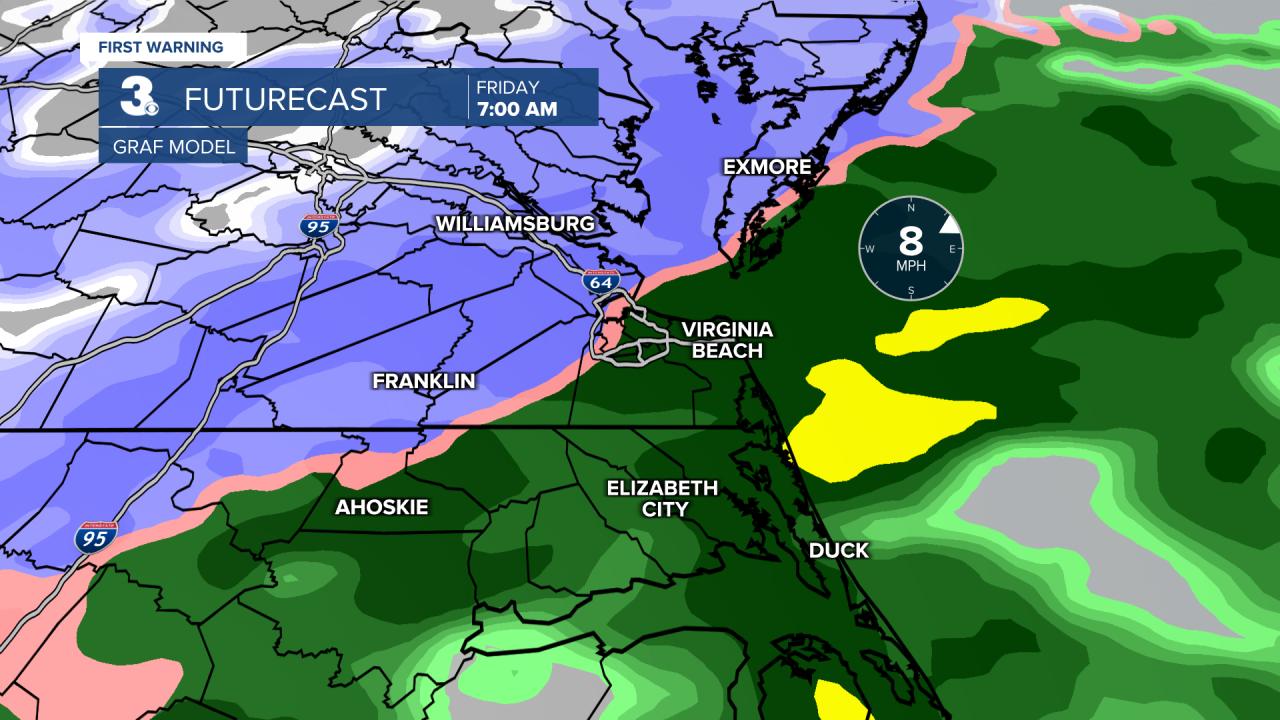
Messy weather returns on Friday. A rain/snow mix is possible Friday morning with better snow chances to the NW and better rain chances to the SE. Precipitation will change to mostly rain by midday. The best chance for snow accumulation with be on the Eastern Shore, Middle Peninsula, Peninsula and inland Southside. Highs will only reach the mid 40s on Friday.
A chilly weekend with highs in the 40s to near 50. Expect mostly cloudy skies on Saturday and partly cloudy skies on Sunday. An isolated shower is possible both days, but most of the weekend will be dry.
The cold air sticks around as high temperatures remain in the 40s and 50s for most of next week.
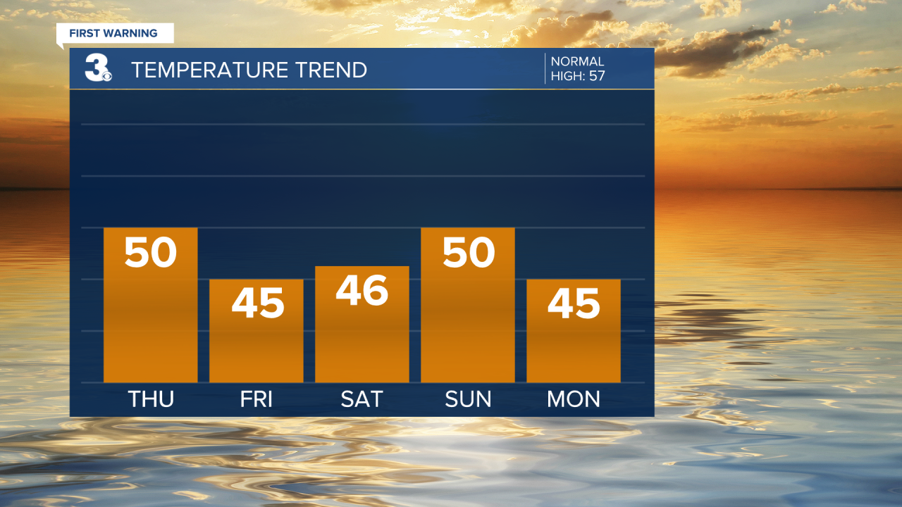
Today: Building Clouds. Highs near 50. Winds: W/N 5-10
Tonight: Mostly Cloudy. Lows in the mid 30s. Winds: NE 5-10
Tomorrow: AM Mix, PM Rain. Highs in the mid 40s. Winds: NE 5-10
Weather updates on social media:
Facebook: MylesHendersonWTKR
Instagram: @MylesHendersonWTKR
