

Derrah Getter's First Warning Forecast
The rain and gloomy conditions could extend beyond this weekend as Hurricane Humberto and Tropical Depression Nine approach the east coast.
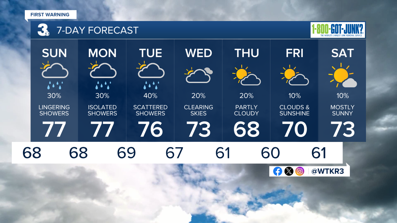
This evening scattered showers and storms will begin spreading across the area. Heavy rainfall will post the threat of flash flooding. Lows will be in the upper 60s and low 70s.

Some of Saturday night’s showers linger into early Sunday morning. Conditions begin drying out in the afternoon, but mostly cloudy skies will remain. High temperatures will be in the upper 70s.
Early next week, we could see some tropical moisture and rough coastal conditions from Hurricane Humberto and Tropical Depression Nine.
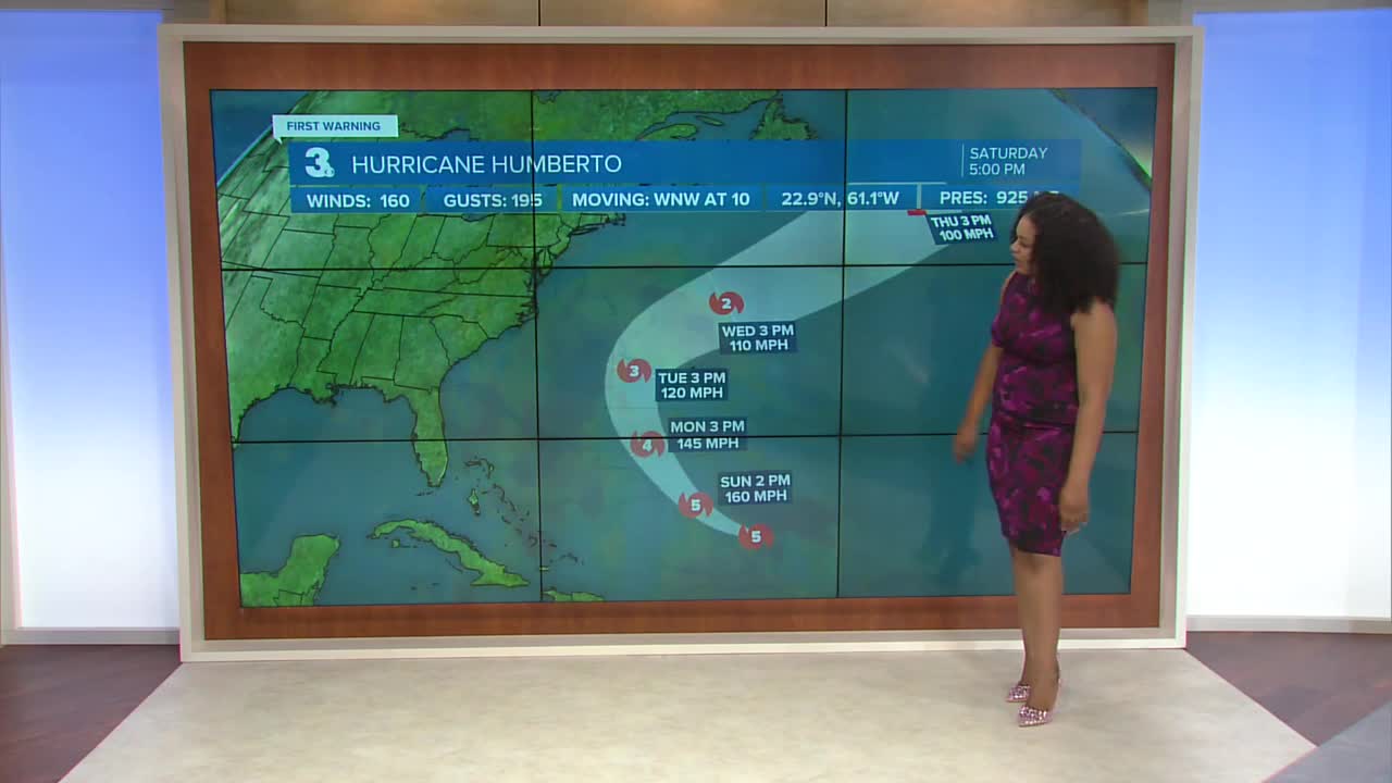
2025 Atlantic Hurricane Season Update:
Tropical Depression Nine is currently located just north of eastern Cuba. Winds are sustained at 35 mph. Very slow strengthening is expected over the next several days and there still lies a lot of uncertainty past 72 hours. The current forecast track shows the storm staying just off the Carolina coast then making a sharp turn away. It is still too far out to pin down specific impacts, but this set up still poses the threat of coastal erosion for portions of the Outer Banks and heavy rainfall.

Humberto strengthened to a category 5 hurricane. It is expected to maintain its strength as a major hurricane through early next week. It’s forecast track takes it away from the U.S. coastline and confidence that this will play out as forecast is high.

Let's connect on social media!
Forecaster Derrah Getter:
For weather updates on Facebook: HERE
For weather updates on X: HERE
Follow me on Instagram: HERE
Check out the Interactive Radar on WTKR.com: Interactive Radar
