


Meteorologist Myles Henderson’s First Warning Forecast
Chilly again today, warmer tomorrow, even colder to start next week. A few smaller rain/snow chances for Friday and Sunday.
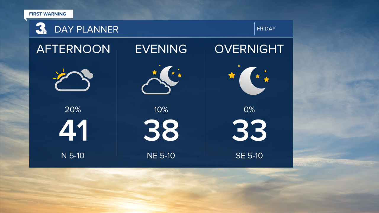
We will only warm into the low 40s today, almost 15 degrees below normal for this time of year. Expect mostly cloudy skies with an isolated rain/snow shower possible. Clouds will clear out this evening with temperatures falling back into the 30s.
We will get another one-day warm-up on Saturday with highs climbing into the 50s. Expect a nice mix of mostly sunny to partly cloudy skies.
A cold front is set to move through on Sunday. Temperatures will reach the low 40s in the morning, then fall into the 30s by the afternoon. We will see a mix of clouds and the wind will kick up. Scattered rain/snow showers are possible on Sunday as the front moves through, but little to no accumulation is expected.

Even colder air is set to move in early next week, behind the cold front. Temperatures will start in the teens and 20s Monday morning with a wind chill in the teens and single digits. Highs will only reach the mid 30s on Monday.

Today: Mostly Cloudy. Highs in the low 40s. Winds: NW 5-10
Tonight: Partly Cloudy. Lows near 30. Winds: NE/SE 5-10
Tomorrow: Partly Cloudy. Highs in the mid 50s. Winds: SW 5-10
Weather updates on social media:
Facebook: MylesHendersonWTKR
Instagram: @MylesHendersonWTKR
