


Meteorologist Myles Henderson’s First Warning Forecast
Much cooler and windy this weekend. Clearing out today but tracking a few showers for Saturday.
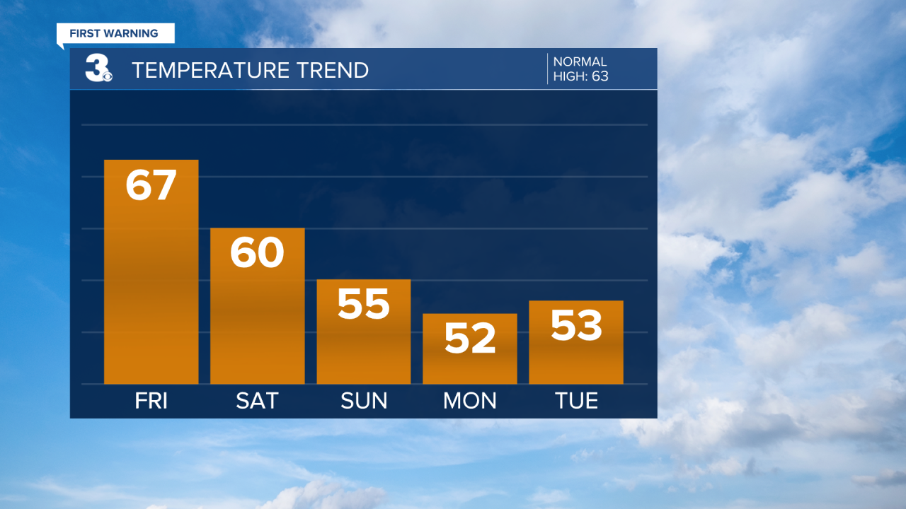
We will start today with mostly cloudy skies and leftover showers. Most of the rain will be in NC and along the coast. We should see more sunshine breaking out by midday. Highs will reach the mid to upper 60s today, not as warm as yesterday but still above normal for this time of year.
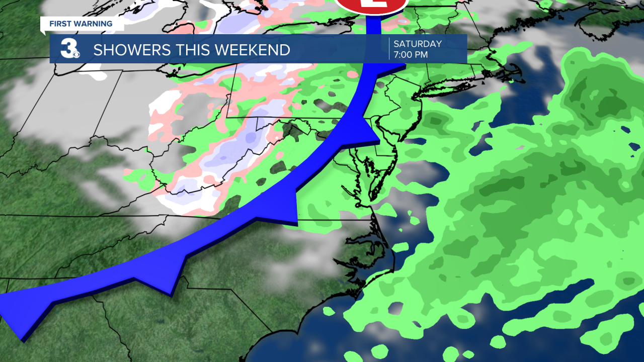
Even cooler air will settle in this weekend. Highs will only reach the low 60s on Saturday. Expect sunshine in the morning with more clouds and scattered showers by the afternoon to evening as a cold front moves through. Winds will kick up tomorrow, west at 10 to 20 with gusts to 30 mph.
Highs will only reach the mid 50s on Sunday. We will see a nice mix of sun and clouds, but it will still be windy with NW winds at 10 to 20 and gusts to 30 mph. We will start next week in the 50s but climb back to the 60s and 70s by midweek.
Today: AM Showers, Clearing Skies. Highs in the mid 60s. Winds: W 5-15
Tonight: Partly Cloudy. Lows in the upper 40s. Winds: W 5-10
Tomorrow: AM Sun, PM Showers, Windy. Highs near 60. Winds: W 10-20G30
Weather & Health
Pollen: Medium-High (Juniper, Elm, Poplar)
UV Index: 5 (Moderate)
Air Quality: Good (Code Green)
Mosquitoes: Low
Weather updates on social media:
Facebook: MylesHendersonWTKR
Twitter: @MHendersonWTKR
Instagram: @MylesHendersonWTKR
