


Meteorologist Myles Henderson’s First Warning Forecast
A cooler end to the workweek with highs in the 70s. Another round of rain to end the week.
Showers and storms early this morning. Rain will be moving out around sunrise, and we will see clearing skies this afternoon. Temperatures will only warm to near 70 today.

Thursday looks good with mostly sunny to partly cloudy skies and highs in the low to mid 70s (near normal).
We will warm to the upper 70s on Friday with partly cloudy skies and a few scattered showers.
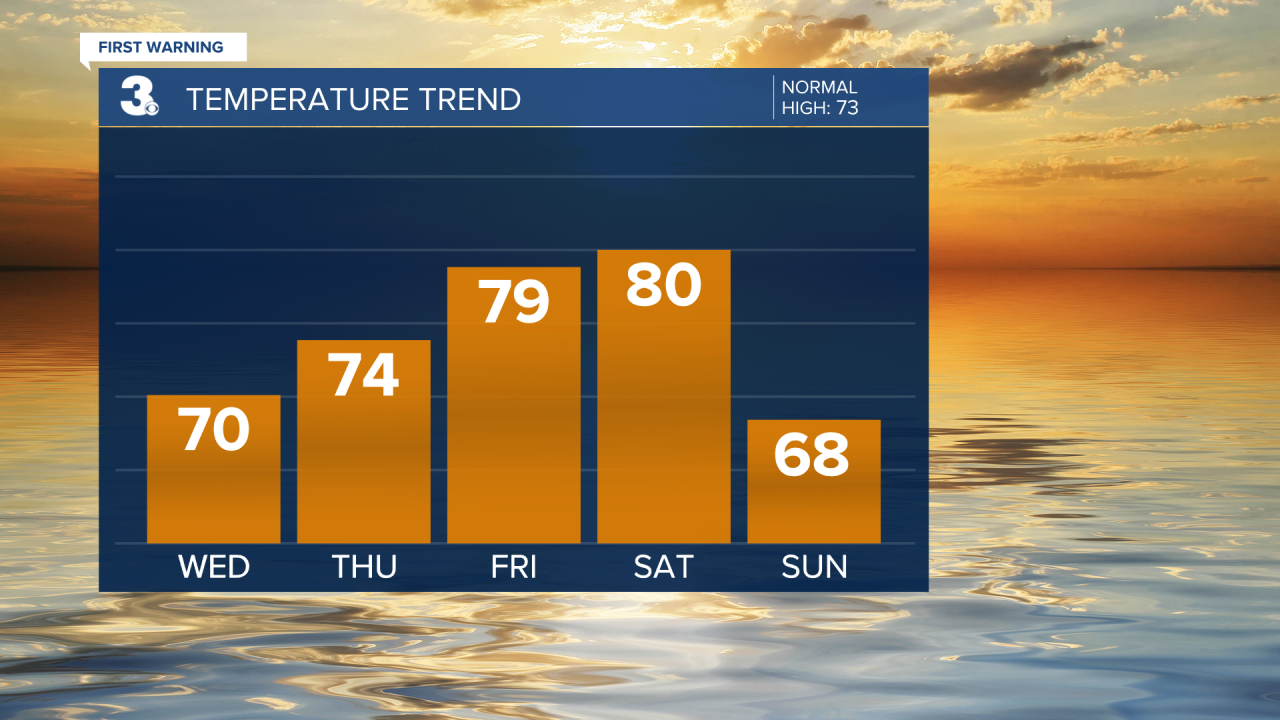
Showers and storms are likely on Saturday as a cold front moves in. Highs will warm to near 80 on Saturday and the wind will pick up.

Much cooler on Sunday with highs in the upper 60s. Look for clearing skies and a strong NE wind.
Today: Early AM Storms, Clearing. Highs near 70. Winds: NE 5-15
Tonight: A Few Clouds. Lows in the mid 50s. Winds: E 5-10
Tomorrow: Partly Cloudy. Highs in the mid 70s. Winds: E 5-15
Weather & Health
Pollen: Medium-High (Trees)
UV Index: 6 (Medium)
Air Quality: Good (Code Green)
Mosquitoes: High
Weather updates on social media:
Facebook: MylesHendersonWTKR
Instagram: @MylesHendersonWTKR
