




Meteorologist Myles Henderson’s First Warning Forecast
A soggy stretch through midweek. A coastal storm brings strong wind and flooding for the second half of the week.
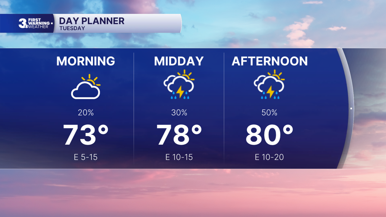
Clouds will continue to mix in today from partly to mostly cloudy. Scattered showers/storms will build, mainly this afternoon to evening. Temperatures will only climb to near 80, near normal for this time of year. Winds will pick up through the day, east at 10 to 20 mph.
Get ready for a messy midweek as a front stalls out over the region and an area of low pressure spins up off the coast. Expect mostly cloudy skies with showers Wednesday and Thursday. Rain could be heavy at times with localized flooding possible.
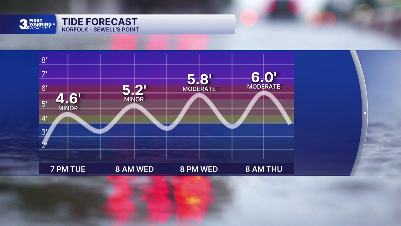
The coastal storm will bring strong wind and coastal flooding. Wind gusts could reach 40+ mph for our coastal communities and 30+ mph inland. The strong NE winds will trigger moderate to major level coastal flooding near times of high tide Wednesday and Thursday.
Conditions should improve for the weekend with highs in the low to mid 70s and lower humidity.
Today: Scattered Showers & Storms, Breezy. Highs near 80. Winds: E 5-20
Tonight: Showers & Storms, Windy. Lows near 70. Winds: NE 10-20 G30
Tomorrow: Mostly Cloudy, Rain, Windy. Highs in the mid 70s. Winds: NE 20-30 G40
Weather & Health
Pollen: Low (Ragweed)
UV Index: 5 (Medium)
Air Quality: Good (Code Green)
Mosquitoes: Extreme
Tropical Update
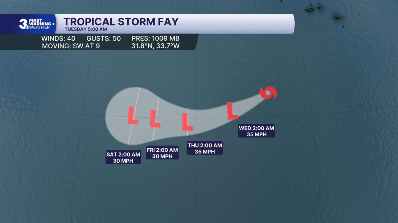
Tropical Storm Fay continues to weaken over the open Atlantic. Continued weakening is forecast, and Fay is likely to degenerate into a post-tropical remnant low by late Tuesday.
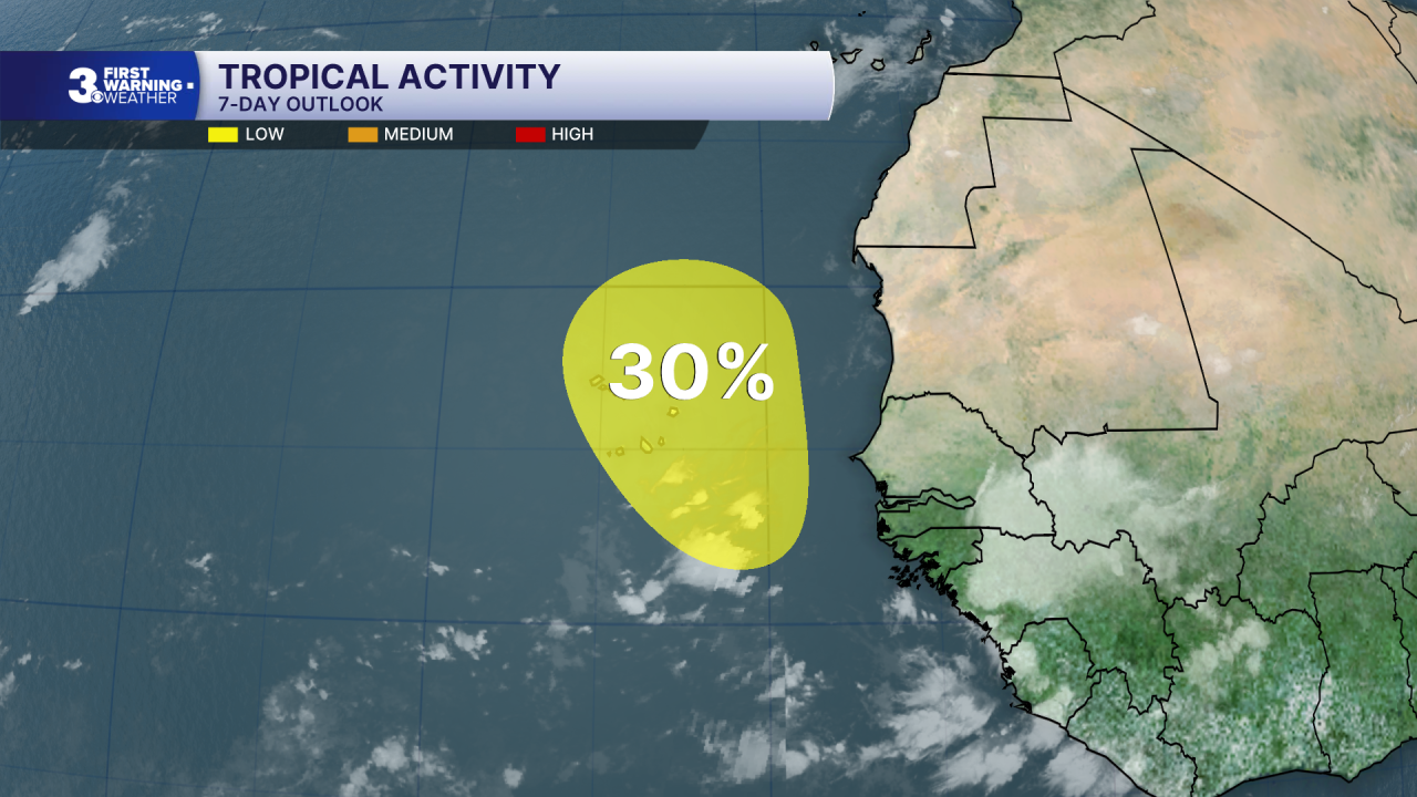
A tropical wave is forecast to move off the coast of western Africa by Wednesday. Although environmental conditions are not expected to be particularly conducive, some slow development of this system is possible when it moves across the far eastern Atlantic.
* Formation chance through 48 hours: Low (0%)
* Formation chance through 7 days: Low (30%)
Weather updates on social media:
Facebook: MylesHendersonWTKR
Instagram: @MylesHendersonWTKR
