


Meteorologist Myles Henderson’s First Warning Forecast
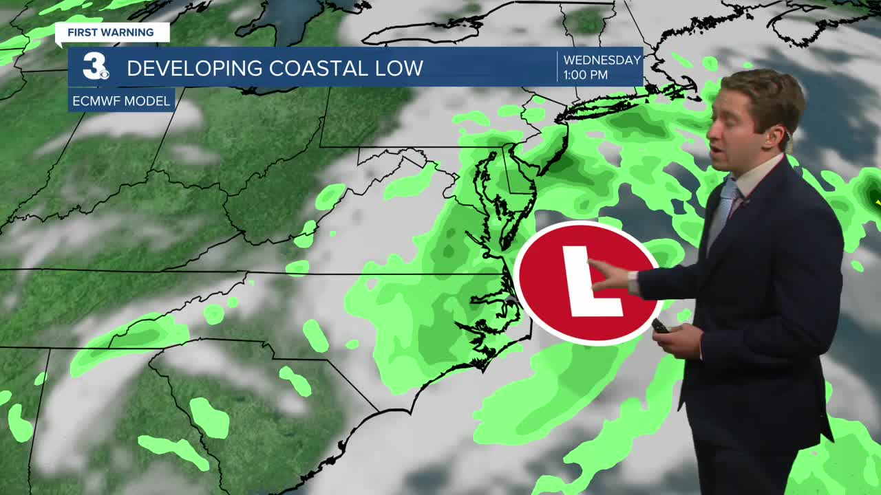
A coastal low develops along the Mid-Atlantic coast, bringing us rain, wind, and tidal flooding to start the week.
Expect mostly cloudy skies today with scattered showers building in from south to north. The wind will increase throughout the day with gusts to 30+ mph by this afternoon. Highs will return to the mid 70s.

Tuesday will be a messy day. Expect widespread rain, especially in the morning. Winds will continue to gust to 30+ mph. The persistent NE winds will trigger flooding near times of high tide.

Winds will back down on Wednesday, and the showers will become more scattered. Most of SE VA and NE NC could see 1” to 3” of rain (with locally higher totals possible) through the first half of the week.

Look for more sunshine and a warming trend to end the work week. Highs will reach the low to mid 80s on Friday.
Today: Scattered Showers, Windy. Highs in the mid 70s. Winds: NE 15-25G35
Tonight: Rain, Windy. Lows in the mid 60s. Winds: NE 15-25G35
Tomorrow: Rain, Windy. Highs in the mid 70s. Winds: NE 15-25G35
Weather & Health
Pollen: Medium-High (Ragweed)
UV Index: 3 (Medium)
Air Quality: Good (Code Green)
Mosquitoes: Very High
Tropical Update
Tracking a tropical wave over the central tropical Atlantic. Although dry and stable air is expected to limit development during the next day or so, gradual development is anticipated thereafter. A tropical depression is likely to form by the middle to latter part of this week as the system moves WNW over the central tropical Atlantic.
* Formation chance through 48 hours: Low (30%)
* Formation chance through 7 days: High (80%)

Weather updates on social media:
Facebook: MylesHendersonWTKR
Instagram: @MylesHendersonWTKR
