




Meteorologist Myles Henderson’s First Warning Forecast
More fall-like this week with cooler temperatures and lower humidity.
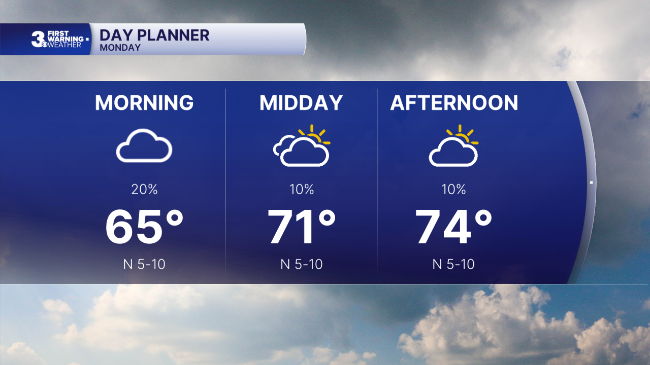
Look for a clearing trend today. We will start with cloudy skies, drizzle, and mugginess this morning. Clouds will clear out through the day, and the humidity will start to drop. Highs will reach the mid 70s, near normal for this time of year.
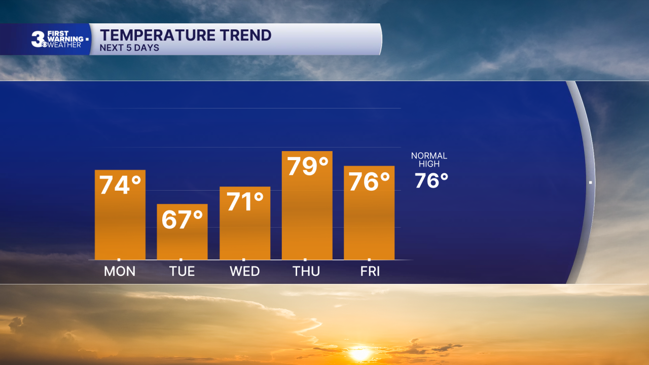
Lots of sunshine through midweek. Highs will drop to the upper 60s on Tuesday, then a warming trend with highs in the low 70s Wednesday and upper 70s Thursday. It should be very fall-like with dew point values in the 50s and 60s.
Cloud cover and rain chances will increase for the weekend as a front to our south starts to drift north.
Today: Clearing Skies. Highs in the mid 70s. Winds: N 5-10
Tonight: A Few Clouds. Lows in the upper 50s. Winds: N 5-10
Tomorrow: Sunny. Highs in the upper 60s. Winds: NE 5-15
Weather & Health
Pollen: Low-Medium (Ragweed)
UV Index: 4 (Medium)
Air Quality: Good (Code Green)
Mosquitoes: Very High
Tropical Update
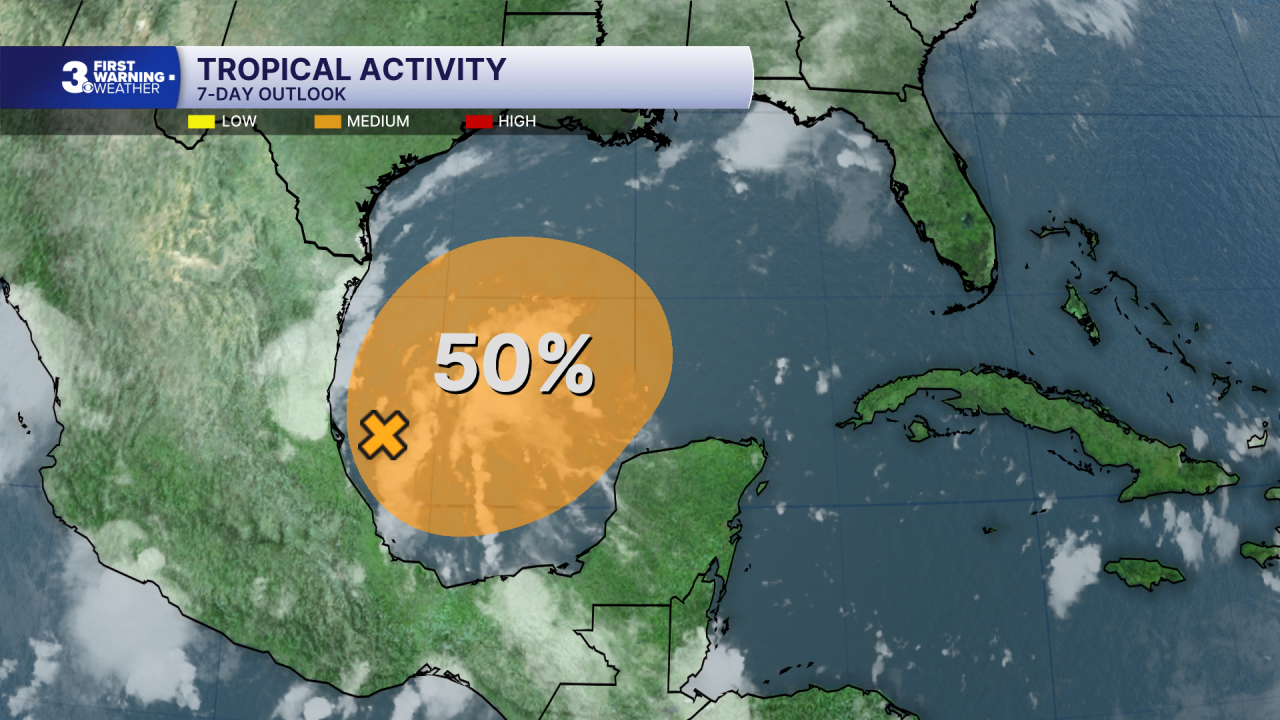
A trough of low pressure has developed along the coast of Mexico in the southwestern Gulf. Although environmental conditions are expected to be only marginally conducive, gradual development of this system is possible and a tropical depression could form by the second half of this week while it initially drifts east before turning north.
* Formation chance through 48 hours: Low (10%)
* Formation chance through 7 days: Medium (50%)
Weather updates on social media:
Facebook: MylesHendersonWTKR
Instagram: @MylesHendersonWTKR
