


Meteorologist Myles Henderson’s First Warning Forecast
A cooling trend to end the week with highs dropping to the 60s again. Watching a 50/50 weekend with rain on Saturday and sunshine on Sunday.
A mild start this morning with temperatures near 60. Highs will only warm to near 70 today, just a bit below normal for this time of year. We will see a mix of partly to mostly cloudy skies with a spotty shower possible.

Expect partly cloudy skies on Friday with temperatures taking another step cooler, into the upper 60s. A spotty shower is possible Friday night, but most of the day should be dry.
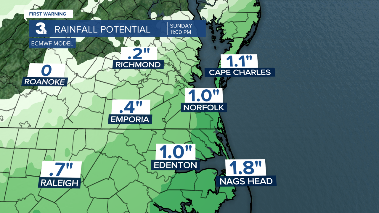
Get ready for a 50/50 weekend. Saturday will be cloudy with rain as an area of low pressure slides up the Carolina coast. Expect more rain to the SE and less rain to the NW. Skies will clear on Sunday and we will see more sunshine. It will be cooler this weekend with highs in the low to mid 60s.
Warmer air returns next week with highs climbing to the 70s and 80s.
Today: Mix of Clouds. Highs near 70. Winds: N 5-15
Tonight: Partly Cloudy. Lows in the low 50s. Winds: N 5-10
Tomorrow: Partly Cloudy. Highs in the upper 60s. Winds: N/E 5-10
Weather & Health
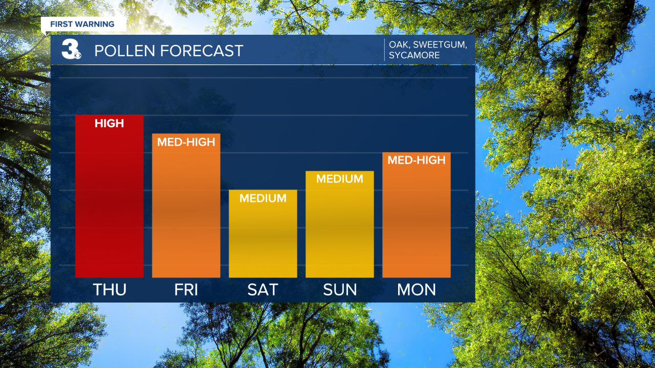
Pollen: High (Oak, Sweetgum, Sycamore)
UV Index: 6 (Medium)
Air Quality: Good (Code Green)
Mosquitoes: Moderate
Weather updates on social media:
Facebook: MylesHendersonWTKR
Instagram: @MylesHendersonWTKR
