


Meteorologist Myles Henderson’s First Warning Forecast
Cooler today, warming trend going into the weekend. Tracking a few rain chances to end the week.
Lots of sunshine today but a step cooler. Highs will only climb to near 60 today, about 10 degrees cooler than yesterday and about 5 degrees below normal for this time of year. It will still be breezy this morning to midday with the wind backing down this afternoon to evening. Lows will drop into the 40s and 30s overnight.

Another nice day on Friday with highs warming to the upper 60s. Expect sunshine in the morning with clouds building in through the afternoon. A cold front is set to move through late Friday night to Saturday morning. Most of the rain will fall apart before it gets here, but a spotty shower is possible.
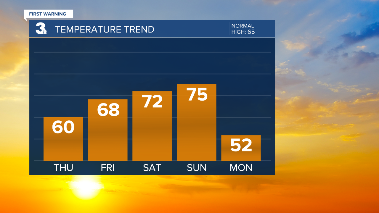
Highs will warm to the 70s this weekend. Low 70s on Saturday and mid 70s on Sunday. Another cold front will move in on Sunday and could give us a bigger chance for showers and even an isolated storm.

Today: Mostly Sunny, Breezy. Highs near 60. Winds: N 10-15
Tonight: Clear Skies. Lows in the low 40s. Winds: N/S 5-10
Tomorrow: Building Clouds. Highs in the upper 60s. Winds: S 5-15
Weather & Health
Pollen: Low (Ragweed)
UV Index: 4 (Moderate)
Air Quality: Good (Code Green)
Mosquitoes: Moderate
Tropical Update
No tropical activity at this time
Weather updates on social media:
Facebook: MylesHendersonWTKR
Instagram: @MylesHendersonWTKR
