


Meteorologist Myles Henderson’s First Warning Forecast
A break from the heat to start the work week. A summer-like stretch to end the week with highs in the 90s and “pop-up” storms.
Warm and muggy this morning with temperatures near 70 degrees. Temperatures will struggle to reach 80 today with falling humidity. We will see mostly sunny skies today, but it will be windy with a NE wind at 10 to 20 mph.

Winds will relax for tomorrow with a mix of sun & clouds. Highs will warm to the low 80s tomorrow, near normal for this time of year.
The heat and humidity return for the second half of the week. Highs will reach the low to mid 90s. Afternoon heat index values will climb to the triple digits for Thursday and Friday. We will see partly cloudy skies with a chance for a “pop-up” shower/storm each day.
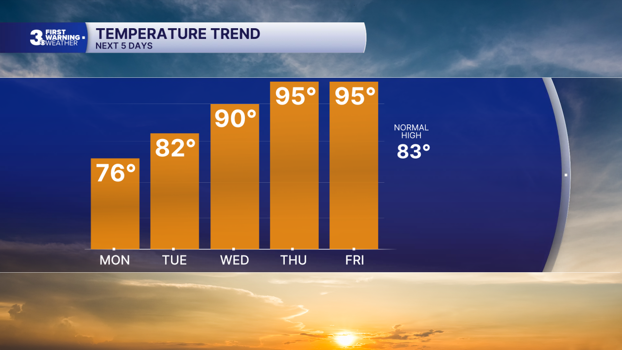
The summer-like pattern with highs in the low 90s and “pop-up” storms will continue for the upcoming weekend.
Today: Mostly Sunny, Breezy. Highs in the mid 70s. Winds: NE 10-20
Tonight: Partly Cloudy. Lows near 60. Winds: E 5-15
Tomorrow: Partly Cloudy. Highs in the low 80s. Winds: SE 5-10
Weather & Health
Pollen: Moderate (Trees & Grasses)
UV Index: 9 (Very High)
Air Quality: Moderate (Code Yellow)
Mosquitoes: Very High
Tropical Update
No tropical activity at this time
Weather updates on social media:
Facebook: MylesHendersonWTKR
Instagram: @MylesHendersonWTKR
