

Patrick's First Warning Forecast
The hottest day of the year may be on the way, along with dangerous heat index values of up to 110°.
Heat and humidity will really start to increase on Friday as a warm front crosses our region. Highs will reach the low to mid 90s with an afternoon heat index around 100°. We will see a mix of sun and clouds through the day with scattered showers/storms moving in by the late afternoon and evening.

A cold front will approach the area this weekend. Unfortunately, it won't ever get here. This time of the year, cold front often die out before they get to us. What's left is called a trough of low pressure. It could be the focus for more showers and thunderstorms
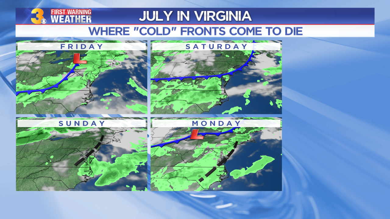
Highs will remain in the low to mid 90s this weekend with even more humidity. Afternoon heat index values will reach the triple digits (100-105). We will see a mix of sun and clouds with scattered showers and storms possible Saturday late and mainly early Sunday. The heat, humidity, and storms will continue for next week.

Monday may end up being the hottest day of the year. So far, we've hit 96 twice. We're forecasting a high of 97 degrees, with feels-like temperatures approaching 110°.
